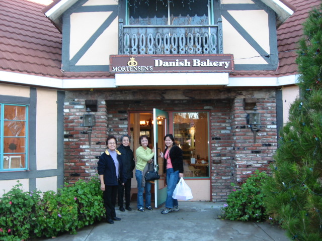
From Hanoi Old Quarter, where we stayed at a cramped but comfortable hotel –Hanoi Guest House– along Mã Mây Road, a van took us eastward for a three (3) hour drive along Vietnam’s countryside.
The ride ended at a nondescript, squat, white-washed terminal building (Tuan Chau International Marina), whose design seemed a bit out of place. Our guide instructed us to wait while he purchased our entrance tickets.
My initial impression of the place was, “here we go again, just another tourist-packed place hyped up by all those travel magazines.”
All ‘junk boat’ tours to Halong Bay start at this architecturally-inapt building.Ruby and Rosan wait for their boat ride.A brightly decorated boat — always ready for the Halong Bay cruise
It was not until we went past the visitors’ building and saw the open waters as we followed the crowd of tourists queuing for their boat rides that my biased, unimpressive opinion about the whole trip slowly gave way to both astonishment and awe.
For US$72 or less (depends on what tour company you booked with) that included stops for lunch (not free) & some shopping along the way, as well as the included simple lunch during the boat ride in the bay, it was an okay deal as you’re visiting a UNESCO World Heritage spot.
Scorpion and snake-infused ‘medicinal’ wine, anyone???A ‘cooking show’ on the boat just before serving lunch
Whether you’re part of a big group or hire a unique boat all for yourself, Halong Bay is sure to offer that special connection with nature and add credence that traveling is the best form of education. One’s romantic notion of a place, as seen in those glossy magazines and books, will now depend on your perception while you’re there. You can now paint your picture.
Among nature’s wonders
Our Halong tour had two (2) options: explore some islands by a smaller boat (maximum of 4-5 persons) helmed by an experienced boatman or paddle a kayak (for two) on your own. It also included a longish stop at an island where you’ll hike up a steep bluff to explore the caves — this sweetened the deal.
Up this steep bluff lies one of the entrances to the cavesTime and water created these mammoth formations inside the caves
Depending on your budget, it would be a good idea to spend a night or two and explore the other bay areas where you can walk along its shores and swim while having a nice view of everything.
We did not see activities like swimming or other water sports in the nearby areas where most of the tourist buses parked.
You can ride a smaller boat or paddle a kayak to explore the numerous islets.These islets dot the Gulf of Tonkin.
On that return trip to your hotel, you’ll have that smile that you have finally visited that “famous, picturesque place in Vietnam.”
Day 1 – Jan. 31, 2016 – (Sunday): Nueva Ecija, here we come
Rey, who would be driving, arrived at my aunt’s house at about 3:45 AM that balmy Sunday morning. January is usually the height of the dry season in the archipelago. Still, the calm westerly winds also gave that early part of the day a relaxed and almost comforting atmosphere.
I hardly slept that night, still suffering from the late effects of jet lag and the non-stop noise from the tricycles and scooters. My aunt’s house straddled the main road in that part of Imus (a city in the province of Cavite) that had become a veritable commercial area — a far cry from the rural appeal the place had for me, where I finished my high school years in the mid-70s.
We wasted no time and left for Mandaluyong, where we picked up Rona (my sister-in-law), her mother, Nita (my mother-in-law), and Ronald‘s family (his wife, Winnie, and their twin sons, Dominic and Benedict), as we were running late. But not after stopping by a drug store where Rey bought some medicine for his stomach ulcer and at a gas station where we inflated the tires to their correct pressure. After all, the trip to Nueva Ecija would be about 5-6 hours, despite our very early start.
Ronald married a coworker while he was a teacher in a private school near San Juan, Metro Manila. Winnie‘s parents hail from Santo Domingo, Nueva Ecija,where both had been tilling a sizeable piece of farmland entrusted to them.
Like most farm workers in the Philippines, they don’t own the title to the land but only get a portion of the rice harvest. Nueva Ecija owns the title of being the “rice granary of the Philippines.“
English: Map of Nueva Ecija showing the location of Santo Domingo (Photo credit: Wikipedia)
It was almost 6 AM when we left Manila and its outskirt cities as we entered the first of three (3) expressways to our destination.
We used a connecting road along Mindanao Avenue in Quezon City to enter NLEX (North Luzon Expressway). This two-lane expressway (equivalent to a secondary highway in advanced countries) would extend all the way to Santa Ines in Pampanga, and then utilize another connector road in Tarlac to another expressway called SCTEX (Subic-Clark-Tarlac Expressway).
We traversed only a short portion of this newly built two-lane highway until it dead-ends in the city of Tarlac, as we veered east to the final expressway, TPLEX(Tarlac-Pangasinan-La Union Expressway).
The road narrowed after we used the Aliaga exit along the TPLEX and found ourselves on the old MacArthur Highway, which was once the main artery for travel north of these islands.
You’re already in Nueva Ecija when you see ‘palay‘ (unmilled rice) on the roadside and passenger tricycles plying the main roads.
We finally arrived in the town of Santo Domingo five (5) hours after we left Mandaluyong. The trip covered approximately 250 kilometers (155 miles), yet it felt like one of the longest days I’ve had on the road, due to the numerous turnouts we took after leaving the expressways.
Winnie’s parent (Willie and Gloria) house is a low-slung, single-story concrete structure located about a few hundred meters from the feeder road, surrounded by rice fields.
I was immediately attracted to a set of varnished bamboo chairs, two of which are longer than the others, on the small veranda of the house that overlooked the rice fields. What perfect spots to take a quick nap!
After the formal introductions, I used my bag as a pillow and stretched my tired body on one of the long chairs that faced the rice fields. At the same time, Ronald and his wife went to the nearest public market using the family-owned tricycle to buy all the ingredients for lunch.
Lunch was almost ready when I woke up an hour later. Winnie had been busy grilling the large yet fresh ‘pusit‘ (squid), several pieces of fish locally called ‘dalag‘ (mudfish), and ‘pork liempo‘ (grilled pork spareribs marinated in ‘calamansi‘ (calamondin)and soy sauce).
Using freshly harvested vegetables from a nearby plot, Winnie’s mother prepared an Ilocano version of “pinakbet“(vegetable salad with shrimp paste). She also made a side dish of green mango salad. On a long table set up outside, heaps of newly cooked rice lie in wait.
Get them while they’re hot!!!
Kids can’t wait for lunch to start.
After lunch, I couldn’t resist taking a few pictures of the rustic scenery and then headed back to my makeshift bed and took another nap. The magnificent view of the verdant rice fields seems to have cast a hypnotic spell upon me that, in no time, I was in dreamland once again.
Lunchtime
‘Palay’ grains dance with the wind.
At about 3 PM, Rey reminded me that we should leave for Talavera before dark, as we might not find it easy to look for my relatives’ place.
I had planned to visit my uncle, “Tata Amado” (the only living brother of my late father),and cousins in the nearby town of Talavera, which was one of the reasons Iagreed to join the trip.
We reached Sicsican Bridgein barangay Calipahan, Talavera– the only landmark I could still remember getting there- in about 40 minutes using the interior roads. We used to collect some pebbles along its banks and traipsed in the river’s clear waters when it was not too deep.
We had to ask for directions twice before we found my cousin Fidela’s house. She was our dear ‘Ate Dely‘ when she was still a teenager and stayed with us in Baclaran. She’s the second eldest in the large family of my uncle, comprising eight (8) daughters (Lucena (†), Fidela, Ila, Vita, Teresa (Tate), Josefina (Fina), Divina,Cristeta (Ata), and an only son, Ambrosio (‘Ambo‘).
‘Ambo‘ is about my age and was my constant companion during my visits, usually, accompanying my father. It had been almost 40 years since my last visit to Talavera. The last time was during the summer break before I entered my first year of college; I had brought my bike along on that trip, and I remember riding it as far as the province’s boundary with Nueva Vizcaya.
While Ate Dely and I got reacquainted, Rey wandered around the surrounding areas.
Winnie and Ronald took this as an opportune time to make a quick trip to nearby Cabanatuan City aboard a tricycle. I moved on to visit the rest of my cousins, whose houses were just next to each other — just a few meters away from Fidela’s.
Although most of the siblings built their houses on the ancestral lot, a portion of their old home, where they grew up, remained.
Upon seeing my Tata Amado in his wheelchair on the veranda of their old house, my mind raced back to when I was in my late teens, and everywhere I looked, it was fresh and expansive.
I still remember the infinite rice fields, the carabaos(water buffalos) in the shed, the giant ‘suha‘ (pomelo), and other fruit trees. And, yes, the quiet, dusty road that led inwards to the town — and the same dusty roads where Ambo and I rode our bikes on our way to Pantabangan Dam, which was in its final phase of construction during that period.
The roads are now busy, and the incessant sound of the tricycles seems to drown whatever peace has remained. Everything seems to have been taken over by a melange of concrete, steel, sheet metal, and other appurtenances that humans euphemistically term progress.
And I felt a deep sadness in my heart and that same question beckoned — “Why do we have to grow old?”
I took pictures, asked questions, and met some of my nephews and nieces whose names and faces I probably won’t remember the next time. They would have all grown up and changed, and will have their own families.
We headed back to Santo Domingo before sunset and stopped briefly at a 7-11 convenience store for three (3) bottles of ‘San Miguel Grande‘ (the ‘national beer’ in a huge bottle). We made another stop at a roadside “ihaw-ihaw“ (barbeque) stall, where we got some grilled “pork liempo“(pork ribs)and “lechon manok” (grilled chicken).
Our companions were already in their sleeping attire when we arrived. We had our beers and BBQ for dinner, along with a plateful of rice and a vegetable dish.
Winnie’s father and brother later joined us at the table as we spent the rest of the evening listening to stories that primarily focused on how their family had settled on the place.
Day 2 – Feb. 01, 2016 – (Monday): The Road Back to Manila
A mosquito net and an electric fan enabled me to get some deep sleep, so I grabbed my camera and took nature’s call outside to take a few pictures of the surrounding areas at daybreak. It was about 6 AM.
The narrow dirt road that led to a cemented one, which would take us to the main highway, was still empty, and the sunrise painted the horizon with varying shades of black and yellow.
Hues of blacks and yellows in the early hours of sunrise
Dawn in Sto. Domingo, Nueva Ecija
I staggered back inside the house to make myself a cup of coffee. Everyone roused up early except one of the twin, still deep in slumber on the sofa bed.
Someone had prepared the kitchen table for a quick breakfast — a Thermos bottle, packets of instant coffee and chocolate, and a blue plastic bag full of bite-sized hot “pan de sal” (lightly-salted bread rolls) were already neatly laid out.
I grabbed a few pieces of the tiny buns as Ronald emerged from the door near a hand-driven water pump, held up two cans, and asked if I wanted corned beef hash or sardines for him to sauté.
“Both,” I replied, and immediately headed to the veranda to enjoy the morning view of the rice fields with my impromptu breakfast.
You could quickly eat 5 to 10 pieces of these very small ‘pan de sal’ during breakfast!!!
Rey and Gloria enjoy the early morning breeze outside the ‘veranda.’
After everybody had their breakfast, we took turns fetching water from the manual water pump using plastic pails for our showers. I used the smaller outdoor toilet near some bamboo trees, and tidbits of memories flooded my brain about how I would go through all these morning rituals during my extended stays with my cousins in Talavera.
It was about 9 AM when we all got ready for the trip back to Manila, but not after passing by the small parcel of land centrally located among all the rice fields in the surrounding areas that Ronald had called “gubat” (forest).
We had to walk along very narrow footpaths to reach it, so we parked the van along the road, near a treehouse. Her wheeled walker prevented my mother-in-law from coming along. Rona decided to stay with her in the truck. She would join us in the ‘gubat’ a few minutes later.
The ‘gubat‘ serves as a perfect resting area and refuge for farmers after tilling the land for hours during the hot, dry months and during the typhoon season when sporadic rains and howling winds batter the rice fields.
‘Manong’ Willie(in the Philippines, particularly in Luzon Province, affixing the word ‘manong’ to a name is a sign of respect)had erected a small hut with elevated flooring made of bamboo and nipa. Bambooand palm – came from the trees that grew abundantly on the fringes of the same tract of land. The underside of the hut served as a temporary coop for native chickens and their young broods until he decided where to build a permanent and larger one on the land.
Except for electricity and a permanent water source, the ‘gubat‘ could be an excellent place to be in case of a calamity, as it’s not only elevated but also self-sufficient. Fruit trees were abundant, and Manong Willie planted vegetables almost everywhere. Several pigs and ducks roamed freely in the open spaces.
Winnie is on her way to the ‘gubat.’
Bamboo trees are abundant inside this tiny forest amidst the rice fields in Santo Domingo, Nueva Ecija.
Entering a new province in Luzon. Out of Nueva Ecija and into Tarlac
The late Filipino senator-turned-martyr and national hero grew up in this house
We lingered for over an hour, and my mind tried vainly to connect the present with my long-gone youth. Time, indeed, has ways to temper even the most outrageous of dreams.
And so, during this brief summer interlude in Nueva Ecija, I realized that although my idealism may have long been gone, my appreciation for life and all its blessings will always remain.
Day 1 – Feb. 15, 2016 – (Monday): Gone to Cagbalete Island
I wiped away the sleep from my eyes at about 3:30 AM, only to find Rona, my sister-in-law, already busy in the kitchen. The night before, we had bought some “pan de sal” at a store adjacent to the place where we had intended to eat a version of the famous “Ilocos empanada” at the “Fariñas Ilocos Empanada“ located across the Mandaluyong city hall complex along Maysilo Street.
However, they had closed earlier than usual that day for general cleaning, so to appease my empanada craving, we bought instead “lechon manok” and “inihaw na liempo” (grilled chicken and pork belly, respectively) from a small stall called “Mang Boks.”
English: Map of Quezon showing the location of Mauban (Photo credit: Wikipedia)
Rona’s youngest son, Matthew – fondly called ‘Balong‘ and who suggested the place – and his wife, Johan (just two months married), with one of my wife’s first cousins, Lelen, would be my companions to Cagbalete Island.
We hailed a taxicab that took us to the JAC Liner bus terminal in Kamias, Quezon City. The bus fare was PHP 270 (USD 5.70), and this was the first of only two daily direct trips to Mauban, Quezon, which would supposedly take about 4 hours. It arrived more than an hour late after making numerous stops – loading and unloading passengers – after it exited the South Luzon expressway in Sto. Tomas, Batangas, and meandered around the cities and towns – San Pablo, Tiaong, Candelaria, Sariaya, Lucena – surrounding mystical Mount Banahaw.
On our way to Mauban, Quezon
Taken from the bus – Candelaria Municipal Hall
Tricycles awaited passengers after they alighted from the bus. We informed one of the tricycle drivers that we were headed to the pier – to Cagbalete Island – so we chose his ride as it was next on the queue anyway. The young driver suggested we pass by the public market to buy supplies we may need on the island.
We needed much more time in the market after realizing how unprepared we were for the trip and being very hungry after the long bus ride that included an extended rest stop in Lucena City‘s grand central bus terminal.
We offered the driver extra money if he would wait for us. He agreed but reminded us again that there were only two daily ferry trips to the island, and the first would leave in about an hour or so. I immediately looked for a place to eat while the rest shopped.
I found a restaurant that advertised “tapsilog” (beef “tapa” – beef marinated in vinegar, spices, and garlic, then dried and fried – with a serving of fried rice (“sinangag”) plus a fried egg (“itlog“)) and placed two orders along with a serving of “bulaló” (beef soup). Balong and Johan arrived a few minutes later with two big jugs of water and cookies. They placed their orders while I bought a package of fish-flavored “kropek” (flour cracklings) from an elderly lady selling an assortment of snacks.
I looked up the menu board again and noticed that the place also served a version of the province’s famous “pancit habhab.” Also known as “pancit lukban” in honor of the town where it originated, the very distinct taste of the noodles is what it’s all about. As soon as we cleaned up our plates, I placed three (3) more orders of the noodle dish for our dinner in case we could not easily find a place to eat on the island. Meanwhile, Lelen looked for beer and some bread to go with the delectable ‘pancit.’
We loaded our goodies into the waiting tricycle. The driver took us first to a nondescript office of the local port authority, where we registered our names and paid the island’s environmental protection fee of PHP 50 (USD 1.05). Several PHP 10 paper tickets served as the receipt with the name of the place we intended to stay on the island scribbled on them.
Paid environmental protection fee here
Back streets of Mauban, Quezon
The oversized “banca“ (canoe) with a double bamboo outrigger was still busy loading some of its cargoes and passengers when we arrived at the port of Mauban at about 10:50 AM.
We registered our names again on a ledger passed around and paid another PHP 50 (USD 1.05) per ferry fee. The boat did not leave until about 11:30. I snapped away on my small Canon camera as the “M/B Neneng” slowly pulled away from the port of Mauban.
We got seated in pairs with a woman in her mid-fifties and a small girl sandwiched between us in the midsection of the boat. I could immediately tell that they were locals returning to the island. As with the rest of the passengers, you could also easily tell who the residents of Cagbalete Island are. Their sun-bronzed skin and low-key demeanor evoked a muted understanding of how life must be on the island.
Natasha looks at the camera
Nearing the port of Sabang
The sticky feeling one gets in Manila dissipated as the overcast weather and cool northeast winds that locals call the “amihan” smacked our faces as the boat progressed east toward its destination.
We had to shout in each other’s faces to communicate as the boat’s diesel engine purred loudly behind us, and the skimpy vinyl covering held up by bamboo poles did not help the cause.
“I hope all our gadgets and devices can hold their charge while we’re on the island,” I yelled to Matthew.
“You will be able to charge your devices on the island,” the woman beside the little girl butted in her low voice.
I smiled to acknowledge her response and asked if she knew where we could stay on the island, as we hadn’t made any reservations yet.
Aling Babyoffered her place for PHP 200 (USD 4.25) a night. I agreed but thought it was too low, so I asked her again if that was really the price she wanted and that we wanted to check out the house first, and she just nodded.
We talked more about the details of her house and how life was on the island, but our conversation was cut short when we noticed that the boat’s engine had stopped. It was almost noon when she reminded me to remove my socks and foot orthosis before we disembarked.
The water at the tiny port of Sabang on Cagbalete Island was very shallow, so we transferred to a smaller ‘banca’ (dinghy boat) that brought us to the white sand-lined banks of the island. People milled around the port, but Aling Baby whisked us to a small alley that led to a series of narrow but cemented passageways. We passed several stores, a ‘barangay’ (village) hall, a billiard parlor, a small chapel, and a tiny stall selling pan-grilled hamburgers.
A satellite dish protruded in front of the wood and bamboo house with a thatched roof that sat right across an old, manual water pump locally called a ‘poso.’ Adjacent to it was an elementary school whose far end would be another narrow passageway leading you to the other side of Cagbalete Island.
Welcome to Cagbalete Island
Best way to get TV signal in Cagbalete island
Nice elementary school for the villagers
A room with a view — the simple joys of Cagbalete Island
We checked the second level of the house where we were supposed to spend two nights on the island and found the two rooms more than sufficient, so we told her that we all agreed to her offer. She informed us that she has another house – without a bathroom – near the island’s other and less populated side.
Although all of us were so tired, having started the day very early, adrenaline kicked into gear, and we all got so excited to explore the island and tagged along with her.
Cagbalete Island: We slept soundly here
Lelen leads the way to the other side of the island
The ‘other’ house was a nicer-looking and more spacious bamboo hut. However, we passed on it after learning that we had to get our water from an old well. And, no TV.
Deepwater well near Aling Baby’s cottage
The muddy portion on the way
We met a couple of tourists going the other way along the ‘cogon’ (wild grass) lined path and followed their tracks as we sidestepped a few puddles and muddied sections. Except for a badly maintained vegetable field operated by the municipal government in a cordoned-off area, there were hardly any other signs of agricultural activity in this part of the island.
The passageway ended at the back of one of the island’s many resorts, Villa Noe, where I eyed another visitor about to take her late lunch in the open restaurant. We marveled at the spectacular beauty and tranquility of the entire place and agreed that ‘this,’ indeed, is the Cagbalete Island we saw in all those beautiful pictures on the web.
We took many pictures, waded in the warm water, and leisurely walked along the white sand coastline headed north as Aling Baby narrated facts and tales about Cagbalete island.
It could have taken us about an hour to walk back to the main port, so we agreed to take another boat ride when we chanced upon one immediately after we passed by a private resort. Although fatigue had finally set upon all of us, we still immensely enjoyed the brief ride as not only did it begin to rain very hard, but also the waves kept splashing water on us aboard the small banca.
Aling Baby takes a break
A ‘banca’ on the quiet waters of Cagbalete
We never realized how soaked we were until after we gave the boatman a token of PHP 100 (USD 2) – he did not ask us for money- and retraced our steps back to Aling Baby’s first house on our dripping wet clothes.
Back at the house, we took turns fetching water from the ‘poso‘ to shower. We saw a series of clotheslines immediately before the front door, so we hung all our wet belongings and tried our best to make ourselves feel at home in the cramped confines of the lower portion of the house.
The rain had turned into a drizzle by 2 in the afternoon when Balong and Johan decided to nap upstairs. They would not come down until about 5:00 to eat some bread and the last of the ‘pancit habhab‘ neatly stored inside a plastic container. The restaurant in Mauban had placed them in three containers, one of which I had given to Aling Baby before she left for her other house to give us some private time. I had also given her PHP 200 (USD 4.25) so that she could “load up” on the satellite dish subscription – PHP 120 (USD 2.50) per month – for us to use the TV upstairs.
She left her two granddaughters in our care when the smaller one did not like to come to the other house with her. The mother of the small girl, Natasha, had just left a month ago for Kuwait to work as a domestic help, while the parents of the bigger girl both worked in Manila.
Both girls were easy to babysit as they played together until the bigger one got tired and decided to nap upstairs. So we kept little Natasha preoccupied with her toys by giving her ‘kropek‘ pieces – which she had particularly loved – whenever she got bored.
So Lelen and I spent that rainy Monday afternoon in Cagbalete island drinking one of the two 1-liter San Miguel beer bottles that blended perfectly with the ‘pancit Lukban,’ the bread, and three pieces of ‘longaniza‘ (local sausages).
Being a fanatic of any famous regional ‘longaniza‘ in the country, I had espied the sausages in one of the ‘carinderias‘ (small stalls that sell ready-to-eat, home-cooked foods) on our way back to Aling Baby’s house. I had requested Lelen to get a few pieces while he also looked for some ice for our already warm beers. All the while, I kept an eye on little Natasha while she played.
Throughout the time Balong and Johan had slept, there was no electricity. Aling Baby had explained to us earlier that her house was hooked up to one of the generators operated by the municipality and that power would come up only from 6 to 10 in the evening.
We babysat her while Aling Baby prepared dinner
Huge squid that would be our lunch the next day
Aling Baby would return a few times to the house to show us the huge squid (medium-sized by her standards) that she had bought for PHP 60 (USD 1.27) and asked how we liked them cooked. She then checked to make sure the TV now worked. She also ensured we were hooked up with the boatman, Sergio, who would take us on a tour of Cagbalete island tomorrow.
Day 2 – Feb. 16, 2016 – (Tuesday): Going Around Cagbalete Island
The effects of the sleeping tablet wore off, and I was up at 4:30, only to find myself alone inside the mosquito net that Lelen and I shared. I strapped on my foot brace and gingerly scaled down the three steps of wood that made up the stairs and saw him already prepared for another day.
Power was still off inside the house, and it was partially dark outside, but the lights were still on in the alley next to the house, illuminating the house while I prepared a cup of instant coffee. Last night, before we slept, Aling Baby’s youngest daughter had brought a Thermos jug with hot water and cups for the purpose.
After the caffeine took its effect on me, the two of us decided to see the beachfront at first light and did not bother to wake up the newlyweds. Again, along the way, some of the stores were already selling bread and cooked food, and we found the ‘chicken adobo‘ inside a glass showcase simply too tempting. It was PHP 30 (USD 1.76) per order and would go well with a few cups of hot rice at PHP 10 (USD 0.21) per. We noted the place and reminded each other to pick up a few orders on our way back from the beachfront.
We took many pictures of life on Cagbalete Island at early dawn: the fishermen tending their boats and fishing nets, an old lady propped on a concrete wall scanning the horizon, a few workers of the resort owned by the mayor of Mauban sprucing up their beachfront, a middle-aged person getting his therapy piling up white sand upon his legs and a few locals just walking along, preparing for the new day.
Early morning in Cagbalete
Not a bad place to have morning coffee
Floating luncheon area
Port of Sabang, as viewed from the northern side of the island
I wished I could have the best of both worlds as I admired and absorbed all the beautiful natural surroundings before me, and I almost cried. I had seen more beautiful ocean views in the Americas but had never relished wading in their cold waters. Here, it was just too perfect.
We headed back to the house at 6:45 and found Matthew already having coffee and the light inside the house back on. Lenlen returned to the ‘carinderia’ for the rice and ‘adobo,’ which we all had for breakfast, along with the ‘adobong pusit‘ (stewed squid) that Aling Baby had prepared.
After breakfast, I informed Aling Baby that we would not spend the second night in the house because we wanted to experience the other side of the island but would still pay her our agreed-upon two-night fee. We also told her we might stay at Villa Cleofas as planned. She offered to cook our meals for us, so she gave her cell phone number on a piece of paper that I hastily shoved in the back pocket of my swimming shorts.
While we waited for Sergio, a vendor dropped by to sell big clams inside two plastic bags for PHP 20 (USD 0.43), so we bought them and handed them over to Aling Baby.
Sergio, – whom locals called “Momo” – arrived before 8:00. We walked a much shorter route to the port where his ‘banca‘ – “Choktaw” – was moored. He and his apprentice guide toured us through the various points of interest on the island, namely:
The “Sandbar” – a narrow piece of land covered in white sand that jutted out even at high tide where mangroves abound. We saw several huts for rent, but they were all empty that day.
At the sand bar
Young mangroves sprouting out from the white sand!
The “Ilog” (River) – an area on the island where salt and fresh water meet. We counted eight (8) fiberglass fish pens in the area, which, according to Sergio, could hold up to 1000 ‘bangus‘ (milkfish) fry per breeding. There would be three (3) breedings per season, and a good harvest in a season could well pay off the initial start-up costs.
A fish farm at the ‘ilog’
The fish pens were empty when we visited
The Snorkel area – we swam and snorkeled in this deeper area where corals and colorful fishes could be found for almost an hour.
Snorkeling is just one of the best ways to enjoy what Cagbalete Island has to offer
Johan shows off a colorful starfish
“Bonsai Island” isnot an island but simply a portion of a reef that shows up during low tide. Two small mangrove patches are interspersed with a few dead ones on the reef, hence the name. Situated directly across Villa Cleofas, it would not be presumptuous to assume that the owners could have given the spot the name to add a little mystique and attract patrons to Cagbalate.
Locals would always be delighted to tell you the story about the cargo ship, loaded with sacks of flour, that crashed into the reef and how the entire population of the island had fresh bread and pancakes for a very long period of time after the disaster.
It was almost 11:00 when Sergio dropped us off at Villa Cleofas so that we could check out the place. We informed a woman inside the restaurant that we wanted to see the cottage we saw online that cost PHP 1500 (USD 32). We passed by a group of tourists in two tents as she led us to the far end of the resort and showed us the 10 x 20-foot room with a single bed and a very thin mattress.
We decided to look for another place after she told us that we would also have to pay PHP 500 (USD 10.64) extra for the electricity -from 6 PM to 6 only- since we were the only guests that would occupy a cottage that night. Mat and Johan volunteered to check out the other resorts north of the island, including Villa Noe.
An hour had passed, but the pair had not returned, so I asked Lelen to look after our things while I took a leisurely walk along the white sands, hoping to encounter them along the way. I walked past a camping-only resort, then an empty but fenced area before Joven’s Blue Sea Beach Resort’s nice bamboo & nipa-made cottages and clean surroundings attracted my attention.
Although the resort was empty that day, I checked out the cottage that was being cleaned to see how it looked inside. Impressed, I picked one –Sampaguita– beside the bathrooms. I informed Mat and Johan, who saw me while I negotiated with one of the resort’s attendants on their way back, that I had already agreed to the same cost of PHP 1500 for a night’s stay here — electricity included.
I Love Joven signage inside the resort
Our home away from home for two nights
We had a very late lunch of “pork liempo” with extra servings of rice (PHP 520 or USD 11) in the resort’s restaurant immediately after we had rested, showered, and settled down in our newly found home for the night.
Sergio and his apprentice showed up a few hours later and accompanied us to that much-hyped ‘Bonsai Island,’ which was very visible during low tide and which we found to be unimpressive at all.
They must have sensed our disappointment with ‘Bonsai Island,’ so Sergio promised they would pick us up again at 6:00 the next morning to show us another ‘ilog‘ as we returned to the resort.
It was already dark when we got back to Joven’s, but our spirits were all buoyed up not only because the entire resort was all lit up but also because Aling Babyhad brought us some food for dinner! In our absence, she had dropped off the dish of “sotanghon” (vermicelli mixed with the clams that we had bought in the morning and sautéed in onions and slivers of ginger), rice, plastic spoons, and the Thermos bottle.
After dinner, Mat and Johan put up the mosquito nets and were asleep by ten while Lelen and I ordered four San Miguels (PHP 45 or USD 0.96 per) from the restaurant. I lit up a ‘katol‘ (mosquito repellent coil) and placed it under the bamboo table to fend off the buggers while we drank our beers until Len decided to call it a day after he had emptied his second bottle.
I did not sleep until 12:30 AM after I had written a few pages in my notebook about what had transpired on that wonderful day on Cagbalete Island.
Day 3 – Feb. 17, 2016 – (Wednesday): Leaving Cagbalete Island
Lelen was already out walking along the shore as I prepared my 3-in-1 coffee mix at 5:30. The electricity would be out in half an hour, but I wasn’t worried since I had charged all the batteries for the camera while I wrote in my notebook last night.
The newlywed woke up an hour later while Sergio and his buddy showed up at the resort after about another hour and brought along the 1.3 kilograms of ‘alimango’ (blue crab) as well as several pieces of smaller crabs local to the islandthat he had placed inside a big plastic water bottle. I ordered them last night, and they cost PHP 400 (USD 8.50) per kilo for the blue crab and PHP 100 (USD 2.13) for the small ones. I also handed over the PHP 1500 (USD 32) boat fee we owed him and his apprentice for yesterday’s island tour.
The morning was crisp, and while the sun had barely colored the horizon, there were a few wispy clouds as we headed south toward the ‘other blog.’ We all glanced at the resort manager as she sat on a chair, a cup of brew in hand, communing with nature as we passed.
A casual stroll along the west side of Cagbalete island
Lelen enjoys the natural beauty of Cagbalete island
Half a kilometer after we passed by Villa Cleofas, the shore inclined a bit, and we noticed more vegetation in the area. Immediately after Sergio showed us the ‘hidden’ swimming pool (actually a swamp) where a lonesome carabao sat nearby, we came to a stop at a gap where a passageway of freshwater funnels out to the bay that seemed to split Cagbalete island into two.
We had Cagbalete island all to ourselves
Cagbalete Island: Castle in the sand
A carabao takes a break at this lagoon
The other ‘ilog’ in Cagbalete Island
We explored the mangrove-lined banks for almost an hour. We concluded that the area must be very popular with campers as we saw a few items that only visitors of Cagbalete island could have brought: empty bottles, cookie and candy wrappers, some shoes and a sandal missing their pairs, and an assortment of various colored nylon ropes left hanging on the bushes.
It was 9:00 when we returned to Joven’s to prepare for our trip home. We opted to take the last boat ride to Sabang to enjoy the lunch that Aling Baby had prepared for us. Sergio had promised earlier to pick us up at exactly noon.
Just like last night, from her house near the well, Aling Baby brought everything we needed to ensure a memorable brunch before we left Cagbalete Island.
She laid out a modest feast for us that included a big pot of steamed rice, the day’s catch, ‘timbungan‘ (goatfish), fried and presented on banana leaves, and all ingredients to make a sumptuous dipping sauce.
Cagbalete Island: Lunch at our all-bamboo cottage
Aling Baby prepared these fried ‘timbungan’ (goatfish) for us, Take me back to Cagbalete Island.
Sergio arrived on time, and amidst the din of the banca‘s engine, all of us remained silent during the brief ride back to Sabang.
Day 1 – Jan. 24, 2016 – (Sunday): The Call of Cabuyao, Laguna
Old habits are hard to eliminate; two of mine are bicycling and swimming. These activities, thankfully, had tempered the late effects of polio on my left leg- an affliction that I got when I was about three years old.
Laguna, particularly Barrio Pansol, had been my swimming locale of choice after I graduated from college and dropped out of medical school. My life was at a crossroads, and I spent a great deal of time contemplating the whys and what-ifs of life in the healing waters of Laguna Hot Springs.
Our van left Imus, Cavite, at about 10:30 AM on a relaxed yet sunny day. We traversed the newly-built connector roads between Cavite and Laguna. We arrived in Cabuyao in about an hour and a half, having picked up orders of “rellenong bangus” (grilled, stuffed milkfish) and “lechon manok” (roasted chicken) from food stalls located along the route.
From Dasmariñas, Cavite, we used this new access road to Laguna.
We stopped to buy ‘Andok’s lechon manok’ (grilled chicken)
Cabuyao was once a sleepy town (now a city) of Laguna, about 27 miles southeast of Manila. We rode past the town on our many cycling jaunts to Los Baños in the days when the South Luzon Expressway, from Manila, went only as far as the municipality of Alabang. We had to use the interiorly-located national highway to go further south.
Barrio Banay-Banay, Cabuyao, is where my first cousin Carol and her husband, Arthur, found a second home after spending most of their careers in Cavite. The couple met at a company that dealt with industrial plastic products located along the national highway in Bacoor, Cavite.
After they got married, they lived near Imus but decided to move here after Arthur’s father passed away, leaving a self-made bamboo hut on a piece of property about half a mile east of the national highway.
We found Arthur roasting “pork liempo” (grilled pork belly) and “inihaw na bangus” (grilled milkfish) on his improvised grill and also got accustomed to the incessant barking of their four (4) dogs — who are these people?
I had been to their place in late 2011, so I immediately noticed the changes. There was a new shed for the carport that Arthur had fabricated himself in his spare time using his rudimentary welding skills. They had also constructed an all-concrete, two-story structure with an open deck in the vacant land at the back of their old house– the bamboo hut.
At Carol and Arthur’s place in Cabuyao, Laguna
The couple’s simple roof deck in Cabuyao
When Carol arrived from their store, we began the impromptu luncheon party. The menu consisted of “pinakbet” (vegetables sauteed in fermented shrimp), “tinolang manok” (organic chicken soup with lots of ginger and young papayas), the ‘lechon manok‘ (grilled chicken), plus Arthur’s ‘pork liempo’ (grilled pork belly) and ‘inihaw na bangus‘ (grilled milkfish).
My uncle, Ricardo (‘Kuya Ading‘, who will turn 95 in a few days), his care provider, Emma, and my three ‘titas‘ (aunts) — Tita Yeyit, Ising, and Nita — accompanied us on this trip. Rey, our driver, also served as our unofficial tour guide, having been on this trip several times.
After lunch, Kuya Ading became bored and requested the group to head back to Imus. I had informed Tita Yeyit several days before the trip that I would be staying in Cabuyao for a few days, so I could revisit my favorite resort in Barrio Pansol, which was just a few kilometers south.
A few hours after the group departed, at about 3 PM, the trio of Carol, Arthur, and me went to the hot springs via the South Luzon Expressway, as traffic would be heavy along the national highway at that time of day, as Arthur suggested.
We passed the new and impressive city hall building complex along the way and emerged at a less busy section of the national highway just a few kilometers from our destination.
Similar to Cavite, several towns in Laguna, near Manila, have undergone rapid urbanization. I felt nostalgic yet saddened by the reality that some familiar spots, which had given the place its rural charm when I visited weekly to swim in its healing waters, had disappeared, replaced by concrete structures with commercial signs.
We parked the van on an empty lot that had once been a restaurant. I was excited to rediscover the place after we had paid the PHP 80 (approximately US$1.70) entrance fee and an additional PHP 100 (approximately US$2) for a dressing room. I immediately felt I was in the same spot as I had been more than two decades ago. Not much had changed around the entire resort.
In the early 1990s, I had long conversations with the late owner, Jesus Candelaria (or “Mang Jess” as I used to call him). He had intimated to me that he had paid very little for the place, which used to be a favorite spot for carabaos (Philippine water buffaloes) to cool off. He had also informed me that most of his sons and daughters were living abroad and that his nieces were the ones who ran the place.
The marvelous waters flow from the north side of a slightly smaller-than-an-Olympic-sized pool, where several boulders – hidden by a wall – further filter them. The water source is the legendary but now dormant Mount Makiling.
We soaked in the spot where the healing waters come out for five (5) hours. In the same area, people with disabilities could sit on a stainless-steel bench hidden from view by the chest-deep water.
The trip back to the house via the national highway was brief, as we had left the resort just after 10 PM. After we hung our wet clothes and towels, showered, and took a quick dinner of the leftovers from lunch, Arthur led me to the bamboo table and held up two-liter bottles of San Miguel beer.
The beers, the greasy meat leftovers, and good stories that reference the past are always the perfect ingredients for a good night’s sleep. I was in bed at 12:30 AM.
Day 2 – Jan. 25, 2016 – (Monday): A Surprise Visit to Barrio Mamatid
Still jet-lagged, I woke up at 4:30 AM and found Arthur already feeding his brood of animals – chickens, hens, roosters, fighting cocks, quails, ducks, geese, dogs, love birds, and two pigs – and so I chatted with him for a while.
Like the Filipino male living in the province, Arthur is a ‘sabong‘ (cock fighting) aficionado. He and his wife, Carol, also operate a small store that primarily sells livestock feed and other necessities for cockfight enthusiasts, located along the main highway about half a mile from their house.
The open spaces adjacent to the newly built house are where Arthur found his joys in life — his inner peace. There, twice a day, he feeds all his farm animals with the same care and devotion a good father gives his children.
Up before dawn, Arthur feeds his flock of animals.
My room in Cabuyao, Laguna, for two nights
At about 6:15, we had breakfast of ‘pan de sal‘ (bread buns), fried eggs, the leftovers of fried ‘bangus‘ (milkfish), pork ‘liempo‘, and the ‘lechon manok‘ from yesterday’s lunch party.
Two hours after Arthur left the house at around 6:45 aboard his Yamaha scooter, I decided to stroll around the surrounding areas and look for a store where I could ‘load’ my cell phone.
In the Philippines, you refill your mobile phone’s airtime with a wide array of ‘loads‘ that span from one day to a year, depending on your budget and need. ‘Loading kiosks‘ had become a cottage industry across the entire island as vendors received a small commission. I found a store right across the city-funded university and opted for the 3-day “GOUNLI50.” However, I found out that most of the gimmicks pandered by some telecom providers in the country almost border on fraud.
Carol and I went to the store at about 11:30 aboard a ubiquitous ‘tricycle.’ It is the most common form of motorized transportation in the country. We ate lunch inside the store after I briefly chatted with Arthur’s elder brother, who lives in a low-slung house located at the backmost part of the property owned by their family.
By 1:30 PM, after we had attended to the needs of store customers, Arthur and I boarded the trusty Yamaha scooter for the trip to Barrio Mamatid, about 6 kilometers southwest of Cabuyao. We would pay a visit to a co-contract worker/friend back in the early 1980s when I worked in Saudi Arabia.
As fate would have it, I met Ernesto’s son, Ervin, in the healing waters of Laguna Hot Springs in Barrio Pansol last night. We exchanged calls and text messages afterward and decided that today would be the most suitable time for his father and me to see each other again after more than 30 years!
We spotted ‘Erning‘ (Ernesto’s pet name) sitting in his “pakwan” (watermelon) stall and yelled out his name. He immediately recognized me, and we hugged each other like long-lost brothers. However, I felt the tug of that mixed feeling of joy and sadness after I saw him up close and realized that he had aged significantly.
We were both in our 20s when we first met on that farm near an oasis in Al’Hair, about 20 miles south of Saudi Arabia’s capital city, Riyadh. Back then, the kingdom was a magnet for foreign contract workers as the country embarked on a massive modernization program funded by the world’s insatiable demand for oil.
Their house sits on a corner lot of about 500 square meters. His youngest son had converted part of the property into a computer rental business. About 25 personal computers with LCD screens operated on the same concept as jukeboxes of yesteryears and were called ‘PisoNet‘ (One Peso Internet). Drop a peso into the slot, and you can surf the net/use the PC for five (5) glorious minutes.
Ernesto handed me a few peso coins, and I showed him some of our old Saudi Arabia pictures on my website. While at the computer shop, I asked him if Laguna de Bay was nearby. In no time, we found ourselves at the lake.
Bong and Arthur near Laguna Lake in Barrio Mamatid
Ernesto informed us that locals can still catch fish in the lake. Siltation has compromised the taste of the fish, though. You will need to clean them very well due to the rapid urbanization on the lake’s fringes, that had rendered the once-clear waters an almost light chocolate color.
All over the Philippines, smaller towns surrounding big cities had slowly lost their rural appeal; most farmlands had almost disappeared due to urban sprawl.
Back inside the house, Ernesto served us “balut” (boiled 18-day fertilized duck eggs), slices of ‘pakwan’, and iced water. At the same time, we reminisced about our days in Saudi Arabia, our families, and, of course, local politics.
We bade our farewells to Erning and his wife at about 3 PM. We headed back to the house using the same roads we took earlier. We passed rice fields transformed into vegetable patches during the off-season, subdivisions, factories, and small mounds of haphazardly strewn garbage along the way.
Back at the house, I rested and showered away the heat. At the same time, Arthur headed back to the store after feeding his flock and preparing a vegetable dish that featured “puso ng saging” (banana hearts or budding banana blossoms). They arrived back from the store at about 6:30 PM, and we had dinner of the same leftovers except for the vegetable dish with copious servings of white rice.
After dinner, Arthur hopped aboard his scooter to buy San Miguel beer in liter bottles. Tonight, he informed me earlier, is one of those two days in a week when any one of his friends would drop by their house and “drink the night away.”
He returned with three (3) bottles of the local brew, and in the area adjacent to the carport, where there is a set of low-slung tables and two long benches made of bamboo, we opened up the first bottle while we waited for his friend. Arthur cracked open all the ‘balut’ that Erning had graciously allowed us to take home (together with a ‘pakwan’) to serve as our “pulutan” (appetizer).
We were halfway through the first bottle when his friend arrived in a nice-looking SUV. He brought a plastic bag containing an orange-colored fried dish called “okoy” (small shrimp with slivers of vegetables deep-fried in batter). Arthur had told me yesterday that he is also the ‘ninong‘ (godfather) of his architect-friend’s older son, and that on some occasions, both father and son would be present during their drinking sprees.
Having finished all three liters of beer by almost 11 PM, I had to go to the bathroom thrice to relieve my bladder before I slept soundly past the wee hours of the morning.
Day 3- Jan. 26, 2016 – (Tuesday): The Commute Back to Imus, Cavite
I woke up at 5:30 AM to prepare for the trip back to Imus, Cavite. We had hot dogs, fried eggs, and big ‘pan de sals‘ for breakfast that Carol had prepared earlier. Afterward, I took a few more pictures of their place before we left at about 8:00 that morning.
From their house, Carol and I took a tricycle (PHP 10 or USD 0.21 per person) to their store, where I bid farewell to Arthur. We hailed a ‘jeepney‘ to the transport terminal in Santa Rosa, where we waited for an air-conditioned van to fill up with passengers. For PHP 55 (approximately US$1.17), we were taken to Pala-Pala, Cavite, where we caught our final jeepney ride to Imus.
Arthur’s ride in the barrio
Two of the couple’s numerous pets
It was a roughly one-hour trip, but the travel time from Pala-Pala to Imus Toll Bridge (the jeepney fare was PHP 10.50 or US$0.22) was about the same, despite the shorter distance, due to traffic. Like Laguna, many “sleepy” towns in Cavite, notably Imus, had fallen victim to rapid urbanization in the early 1980s.
I finally took another tricycle ride (solo for PHP 25 or US$0.53), which I found to be excessive since the distance was just about 400 meters; I should have just walked (if not for my disability) back home. I was in Bayan Luma 3, Imus, by 10:30 AM.
I ate lunch of “chicken afritada” (stewed chicken with tomato sauce) and “Menudo” (a variation of the Mexican comfort food, but not as soupy) at about 11:30 AM. I took a one-hour nap afterward on my Therm-a-Rest.
Ate Nene (wife of my aunt’s late first cousin, Rodolfo ‘Rody’ del Rosario) dropped by around 4 PM, accompanied by a husband-and-wife friend. She was trying to sell a parcel of land owned by her late husband and had brought a sign for the purpose. The property is located at the back of my aunts’ house, three houses away.
Tita Yeyit arrived from shopping with Carol and Nelia (Carol’s sister-in-law) at SM City Bacoor (a huge shopping mall) by 7:00. For dinner, I ate two slices of Shakey’s Pizza that they had brought, and I went to sleep around 9 PM.
The car danced to the rhythm of the almost-howling winds that gust on the stretch of road that connects Interstate 80 with I-680 from Fairfield in the north going southwards to Benicia. Another work day had passed and I was on the road once again for the return trip back home to Fremont — 60 miles away from where I work on that part of the Bay Area.
Fairfield had come a long way since it had been incorporated as a city in 1903. Most of the city’s groundwork was laid-out by Capt. Robert H. Waterman, who, together with A.A. Ritchie, purchased the area’s original grant for $50,000 in 1850.
(1) Richmond-San Rafael Bridge, (2) Golden Gate Bridge, (3) San Francisco – Oakland Bay Bridge, (4) San Mateo-Hayward Bridge, (5) Dumbarton Bridge, (6) Carquinez Bridge, (7) Benicia-Martinez Bridge (Photo credit: Wikipedia)
The new city received a major economic boost in 1942 with the decision of the U.S. Air Force to build the Travis Air Force Base on a huge tract of land surrounded by hills, east of the area. This base was put into good use during the Vietnam War and, presently, still serves as a major departure point for military units based abroad –and maintains its position as the number one employer for most of the city’s population.
Most of the towns situated in the city are nestled among the numerous slopes that dot almost the entire area. Hence, when the winds blowing from the San Francisco Bay arrive into area, these hills serve as conduits for the rushing airflow and may give reason as to why it’s a ‘windy city.’
The entire area is also a favorite stopover of motorists because of its proximity to some of best recreational spots in the entire state.
Napa -with its wineries – and Sonoma -with its famous hot springs & spas – lie southwest, Reno and Lake Tahoe, as well as the state capital of Sacramento, are all within one to two-hour drive away to the north.
And yes, the famous city of San Francisco is just an inviting 45 minutes drive south of Fairfield.
Today, the city is on the verge of another housing boom as more and more denizens of the East Bay –with its ridiculous real estate market prices – opt for the area’s spacious, natural surroundings and moderate weather.
When you’re out for your next trip to Lake Tahoe, San Jose or even just longing to get a glimpse of the Golden Gate Bridge, make sure that you check out some of the natural sights of Fairfield! It’s so easy to know when you’ve arrived in this city – – – the winds will surely let you know!
— Panoramic view of picture above (2.04MB – Apple QuickTime required)
The year was 1977, and Ferdinand Marcos was still the Philippine president. A few months back, Jimmy Carter was sworn in as the 39th President of the U.S., and I had just completed my freshman year in college.
It was our summer vacation, so earlier that week, Ray and I decided to go biking to the hills of Antipolo, Rizal (a quiet but relatively large town approximately 20 kilometers (12.4 miles) northeast of Manila).
I woke up at about 4:00 AM that Sunday, put on my cycling gear, and poured the de-fizzed Coke I had placed in the fridge the night before into the plastic bottles attached to my bike.
After a brief inspection of my steed (tires, gears, brakes), the road map, and my camera, I rolled on — to the scent of fresh-baked ‘pan-de-sal ‘ (small bread buns) in the still-dark streets of Parañaque and headed towards Pasay City…where Ray and his family had moved.
Ray and I were childhood friends in Baclaran, where his family had lived, even by the day I began remembering things. That was until the owner of their apartment unit decided to lease out the entire complex to a Chinese businessman, forcing them to move elsewhere.
He was younger by about 6 years, but we shared the same interests: playing all sorts of street games, billiards, ‘dama‘ (a local version of checkers, usually played in barber shops), swimming at the Manila Bay -its water was still relatively clean, and people could still catch some fish – and, of course, biking.
I called his name through the window in his room, conveniently situated on the side of yet another apartment complex along Facundo Street. He had already prepared the night before and, in no time, we found ourselves pedaling furiously eastward to Pasig, Rizal, which is now a city and part of greater Metro-Manila.
Although not very far from Manila, Antipolo is a cyclist’s bane, as most of it is situated on the eastern slopes of the Sierra Madre mountain range, offering spectacular views of Metro Manila.
But why did we go biking there? It was the month of May, and traditionally, people, especially in predominantly Catholic Philippines, from all over the country, trek to the place to pay homage to the ‘Nuestra Señora Dela Paz y Buenviaje‘ (Our Lady of Peace and Good Voyage) – a black-imaged Virgin that came from Acapulco, Mexico, that was used during the Galleon Trade. Also, numerous spring resorts in Antipolo offer a bit of relief during the country’s hot summer months.
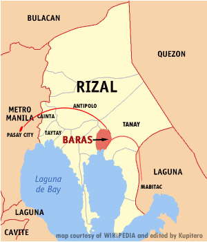
Map showing our starting point in Pasay City (Metro Manila) and the towns of Rizal Province we traversed en route to Laguna.
It took us about two hours to reach the church. After we said our prayers, we bought some ‘kasoy’ (cashew nuts), also abundant in the area, as with the ‘Tipolo’ tree (breadfruit), which the place got its name, and snapped some photo souvenirs, we decided to continue our trek southward to the neighboring towns of Tanay and Baras. Both are still situated in the province of Rizal.
It was mostly downhill from Antipolo, along undulating roads, toward Tanay. So we decided to eat lunch in one of the roadside ‘carinderias‘ (eateries)- they are so ubiquitous along the main highways of the entire archipelago – not long after we reached the flatter sections of the town.
I forgot what we ate, but remembered that we drank more than we ate because of the noonday heat. I also ensured that my two water bottles were full for the impending climb towards Mabitac (part of Laguna Province) via Baras and, once again, Tanay.
I almost gave up as soon as we reached the brutal climbs in Mabitac. Ray, who was riding his trusty ‘play bike,’ was egging me on to continue without realizing that my steel road bike was climbing these slopes on a maxed-out 48-tooth (front chain wheel) by 18-tooth (rear gear) combo while he was leisurely pedaling on a smaller wheel with a 32 by 20 gear ratio!
I barely made it to the top! The cool breeze and the panoramic view of the Laguna de Bay gave me the ‘second wind’ I needed to pursue the journey further south. Besides, the trip back via the same roads would have probably been torture!
The rustic sceneries and the ‘genteel feel’ I had for the small ‘barrios‘ we passed by en route to Mabitac (one of the three towns in Laguna that bordered the province of Rizal – the others being Pakil and Santa Maria) made our pedaling easier than it seemed to be.
From their ‘verandas‘ (porches) or, in front of their hardware stores, old men and women waved at us as we wheeled by.
As if our souls had briefly met high above the clouds and then looked down with puzzlement at the chaos and confusion people were creating for themselves on earth.
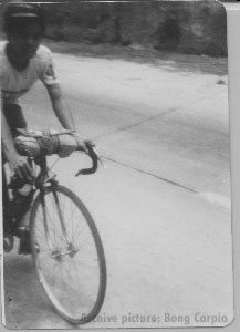
Rolling along the roads of Baras en route to Laguna via Mabitac in this 70s photo
We bade goodbye to the mountains as soon as we entered the municipality (or town) of Famy in Laguna. It is a small town whose western tip briefly borders Laguna de Bay. Most towns in Laguna straddle this great lake, a source of livelihood and many folklores.
From there, the twisting roads of Siniloan led us to the more significant, eastern part of Pangil — vernacular (in singular form) for the ‘fangs of wild boars,’ which were said to be abundant and freely roamed the place.
It rained briefly while we were gingerly traversing a downhill section towards neighboring Pakil. These towns I remembered well as the “three Ps“…the next one being Paete — very well-known for its wood carvings and the sweet and succulent fruit, ‘lanzones.’ How could I not remember the sense of awe Ray and I had felt as we whizzed by these trees with their light-yellow, oval-shaped fruits right above our city-bred heads? We were not used to seeing those trees!
Also, most houses in Paete have small thatched huts, usually detached from their prominent abodes, where their owners can do their carvings. Some of these huts also double as small ‘sari-sari‘ (assorted goods) stores to augment their income.
In one of these ‘sari-sari’ stores along the highway in Paete, Ray and I tasted one of the best ‘pan-de-cocos‘ (bread rolls with sweet coconut fillings) in our lifetime. It was not because they were well-baked but because we werehungry after the lung-busting climbs. We washed them with “Sarsi” (a local brand of root beer, whose aromatic flavor comes from the ‘sarsaparilla‘ vine) and lots of swigs from my now slightly hot water bottles. It was about 2:30 PM, and from Ray’s house in Pasay City, we had been on the road for more than 9 hours!
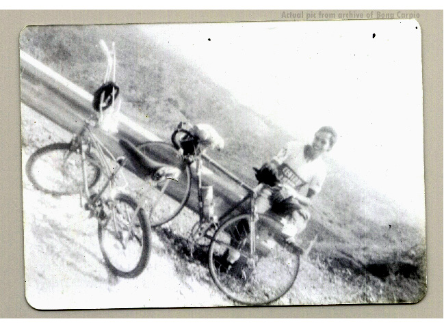
Atop one of the steep hills in Mabitac for a breather. Ray Nario snapped this picture of the author.
And so, we pedaled on to the towns that caressed the southeastern portion of Laguna de Bay. These were: Kalayaan, Lumban, Pagsanjan (although not bordering Laguna de Bay, we decided to pass through this town en route to Santa Cruz because of its popularity and allure), Santa Cruz, and Pila.
It was in Pila where we stopped briefly again to sample one of the roadside delicacies, ‘suman‘ (a long, sticky rice cake whose flavor is enhanced by the coconut leaves it is wrapped in). These we dipped in plain sugar for taste and to replenish our already-depleted body sugar reserves.
I also happened to have a university mate and friend who lived in town, and we briefly considered looking up his house and paying him a surprise visit. But it was almost 5:00 PM, and although it was the peak of summer, we were running out of daylight to cover the remaining nine Laguna towns and cities — and the more than 90 km of not-so-very-easy roads back to Manila. Also, given that our frail bodies were running on whatever glycogen reserves we had, we backed out of the idea and pedaled to the adjacent town of Victoria instead.
From Victoria, our pace was getting slower and slower as we trundled past the towns of Calauan, Bay, and Los Baños, where its steep hills almost zapped the lights out of us and nearly gave in to the thought of sleeping the night over as soon as we hit the town proper.
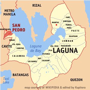
Map of the province of Laguna showing the towns we traversed on that day in 1977 – (shaded yellow with red line)
We knew that we were not far from home as we stopped briefly in the town of Los Baños — very near the road that leads to the International Rice Research Institute (IRRI), situated inside the University of the Philippines at Los Baños‘ (UPLB) sprawling compound.
We were also very familiar with the towns and cities we would pass along the way. Los Baños had been one of our favorite cycling haunts from Manila because of its natural, relaxing hot baths, which are purported to have medicinal properties.
Once again, the downhill-to-flat run from Los Baños towards Calamba boosted our already flagging spirits. We saw the last streaks of sun rays as it finally set on the western horizon as we approached the historical city. Calamba is the birthplace of the country’s national hero, Jose Protacio Rizal.
In one of the restaurants in this time-tempered city, it was only fitting that Ray and I talked over cups of coffee about the roads we had covered and the ordeals we had gone through. We had traveled far and well.
More importantly, we could see through our inner selves… our strengths and weaknesses, our tempers and moods, our bravado, our follies and foibles – as well as our determination. We had lived through yet another day in our youthful lives.
Darkness was upon us as we agreed to move on, for as long as it was not too dangerous for us to ride through the remainder of the journey. And so, we pedaled on to the rest of the towns in the partly-lit roads of Laguna: Cabuyao, Santa Rosa, Biñan, and finally, San Pedro.
It was almost 10:00 in the evening.
We still squeezed some sugar out of our sore leg muscles and moved on to the first municipality on the western side of Rizal Province: Muntinlupa.
Like Pasig in the north, Muntinlupa is now a full-fledged city — the southernmost of greater Metro Manila. While we were just 20 kilometers from Pasay City, it was also here that we finally ended our bicycle saga — for health and safety reasons.
At the BLTB (Batangas-Laguna-Tayabas Bus Company) terminal in the town of Alabang, after asking the driver for permission, we hauled our bikes to the rearmost seat on the almost-empty bus. We slept soundly on the long, foam-padded backseat on our way back to Pasay City.
We had finally come full circle.
BIKE NOTES:
Ray used a ‘Patria‘ brand (a bike shop/manufacturer founded by Tony Kairuz whose main store was located in Buendia Avenue in Makati, Metro-Manila, until it closed shop in the mid-80s) steel-framed ‘play bike’ (“banana” type seat with raised handlebars) with 21″ wheels, single chain wheel with multi-gear back freewheel.
I utilized a locally made, 50 cm. ‘Pigeon‘ brand (a small bike frame builder in Paco, Manila in the 70s that was co-owned by Tour of Luzon lap winner Hermogenes Vinluan) steel-framed road bike with 27″ clinchers on Weinmann aluminum rims & steel spokes, Sugino alloy (52/38) chain wheel with a SunTour Dia-Compe 10-speed gear set (bar-end shift-levers), Universal center-pull brakes and a pair of old-school, Mikashima steel/alloy pedals with Christophe shoe cages and straps.
I already felt the humidity of Bangkok the moment we stepped out of the plane to wait for the service bus that will take us to the main airport terminal. The bus’s air-conditioning hid this fact for a few minutes, and so, the muggy air blasted onto my face anew as soon as we stepped out of the airport to wait for another bus that will us take to our hotel after we had cleared immigration and retrieved our baggage.
Bangkok, despite of what I’ve read and heard from friends about the place, immediately impressed me after the almost 40-minute drive to our hotel, which was located in the heart of downtown…along Petchaburi Road. The roadways were clean and nicely engineered.
Towering concrete posts for the still-undergoing-expansion Skytrain, dotted the right portion of the freeway, but they were left neatly in place –no dangling wood forms nor rusting steel supports.
The country -temples or without- simply showed us that the people is where we sense more the ‘breath of nature’ that moves our innermost heart.
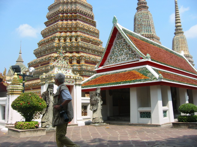
But one thing that awed me were the magnificent temples that literally lined up the entire streets of Bangkok–Budhhism being the main religion of the country. Not only they tempered the modern look of the country, but they also added ‘mystique’ to the already-exotic place.
One of the smaller temples inside the Wat Po (the new name is Wat Phra Chetuphon) ; location of the massive “reclining Buddha”.
After a brief, albeit, refreshing sleep, quick showers followed by the hearty breakfast buffet in our hotel, Bangkok and its magnificent temples, would, once again, dazzle us during the 6-hour morning city tour.
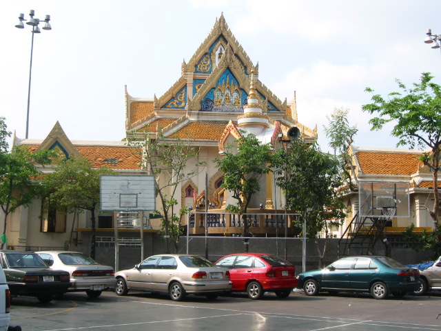
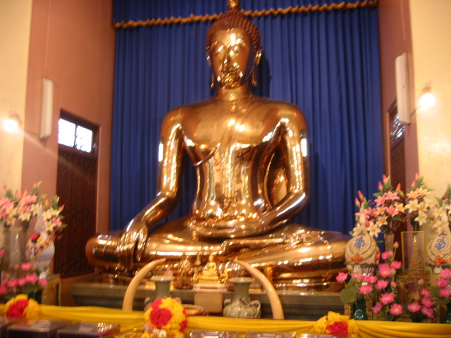
The city tour showcased most of the popular -and bigger- temples in downtown Bangkok that included, the Wat Phra Chetuphon Temple (more popularly known as the ‘Wat Po‘ where the massive ‘reclining Buddha‘ is housed) and the Traimitwitthayaram Temple inside the Chinatown district, where the ‘largest Buddha made of pure gold‘ in the world is located.
One of the smaller temples inside the Traimitwitthayaram Temple Compound where the “largest Buddha made of pure gold” is housed.The “largest Buddha made of pure gold” inside the temple.
Finally, on a trip to the countryside the following day, Thailand not only showed us its gentler side but also visually reminded us that, “all that glitters is not, necessarily, gold.” Why? Inside those temples, while the beauty and craftsmanship of all the icons and statues may mesmerize visitors, they all paled in comparison with the natural warmth and friendliness of the Thai people.
I knew it would be hot and humid, but I went with my wife to visit Manila by the end of March. After all, it had been almost three years since I last sauntered upon its streets — to see again the places that had been mute witnesses to my frivolities in the early years of my adult life.
A few days after our arrival, we began exploring the districts of Santa Ana, Paco, Ermita, and Malate, as well as portions ofIntramuros (the “Walled City” during the Spanish colonial period) and San Andres (formerly part of the Santa Ana district).
The main stretch of Pedro Gil Street (formerly Herran), from Roxas Boulevard to its dead end at the historic Santa Ana Church, where it continues as New Panaderos Streetheading towards Mandaluyong City, offered me a snapshot of what the entire city had gone through over the years.
As always, the area offered a mix of déjà vu, fascination, sadness, and desperation — I had known almost the entire vicinity since I was still an elementary student at nearby Malate Catholic School in the late 1960s.
Not much had changed in the heart of Paco and Santa Ana. Jeepneys, cars, and tricycles, compounded by the narrow streets, continue to choke the area, while numerous patches of urban blight seem to haunt these places perpetually.
The current mayor of Manila has made an effort to give the entire city a fresh look by opening up most of the city parks—the “Paraiso ng Batang Maynila” (Paradise of the Child of Manila)—and installing old, Spanish-style lampposts (ala-Intramuros) throughout the main streets. However, they, too, had become victims of what afflicts the entire archipelago – very poor (if any) maintenance of these improvements and the short-sightedness in planning and design of its overall infrastructure.
Malate and Ermita have seen the most changes due to the construction of new high-rise buildings along Roxas Boulevard, A. Mabini Street, M.H. del Pilar Street, and Taft Avenue, as well as the redevelopment of the bayfront from Vito Cruz Street (near the Cultural Center of the Philippines to Rizal Park (Luneta Park), which Manilans fondly refer to as “Baywalk.”
At the back of the Manila City Hall, along Arroceros Street, I saw the rise of a big mall. However, its overall design – resembling a large piece of hollow block – made the entire vicinity appear less appealing than it once did. Who knows what happened to the small business establishments that once abounded in the area before the mall was built? Gone were the genteel shops and the post-war YMCA that once thrived when the GSIS (Government Service Insurance System) and the DECS (Department of Education, Culture, and Sports) were still located in the same area. Even the improvement of the park (part of Mehan Garden) along Concepcion Street did little to counter the bland look the mall gave to the area.
The sad state of the entire place says a lot about how city managers (present and former) interacted with businessmen and prospective investors to make the place not only commercially vibrant but also to ensure that these establishments blend beautifully, without neglecting its history, with the entire area.
A few days later, I was sweating it out in the districts of Quiapo, Santa Cruz, and Binondo, as well as passing through the San Miguel, Sampaloc, and Santa Mesa districts via jeepneys and the newly built LRT 2 (Light Rail Transit 2 – the “MegaTren”). I had already seen the changes made by the incumbent Manila mayor in the Quiapo-Plaza Miranda areas back in 2002, which, at least, sanitized the Lacson Underpass of vendors, pickpockets, and petty crimes.
While the traffic situation in the vicinities of Manila may have improved because of the LRT 2 -which runs all the way from Recto Avenue to Santolan Road in Quezon City-, the entire city still need a lot of changes in its overall infrastructure (majority of its sidewalks are dilapidated), for it to become at par with its already-modern Southeast Asian counterparts.
Starting from Quinta Market underneath the Quezon Bridge (also known as Quiapo Bridge), we meandered our way to Escolta via Carlos Palanca Street (Echague), passing by the statue of the late Manila mayor, Arsenio Lacson, as well as the nearby Santa Cruz Church, located within the renovated portion of the plaza.
We ambled towards Binondo via Tambacan Street, stopping briefly at Ongpin Street to buy some “machang” (steamed sticky rice with cooked pork or chicken at the center, wrapped in banana leaves) and “siopao” (steamed buns with braised pork/chicken inside) as “pasalubong” (household presents).
Then, it was time to acquire some affordable hardware/home furnishings along Tomas Mapua Street (Misericordia), for which the street is known. We ended our ‘mini-Chinatown tour’ on one of the tables at the ‘Pinsec Noodle House’ (wow, it’s still there!!) along Claro M. Recto Avenue (formerly, Azcarraga), where we enjoyed my old favorites: “beef asado” noodles (braised beef w/ noodles) and “siopao asado”(steamed BBQ pork buns). After washing these down with our favorite soda, a few steps away on Rizal Avenue (Avenida Rizal), we were surprised by one of the most notable changes in the vicinity.
The stretch of Rizal Avenue from Plaza Lacson (near Carriedo) to Claro M. Recto Avenue was ‘pedestrianized.’ The old cement road and the sidewalk were replaced with bricks, and assorted, colorful plant boxes were placed along the sides. Benches made of wood and stainless steel were placed in the center for promenaders to sit on. Lampposts were added to complement the dim lights underneath the LRT 1 (Baclaran to Caloocan City) tracks.
The pedestrianization project, indeed, brightened up the area, and with the ongoing construction of a mall (hopefully, with a design that could recreate the grandeur or ambiance of the place after WW II) where the former Odeon Theater was located -as well as the timely opening of the modern, 4-story, LRT 2-Recto Station nearby-, ‘Avenida‘ as it was more popularly called, may well have found the recipe for its rebirth.
We almost walked the entire length of the ‘new’ Avenida, from where we veered left towards Gil Puyat Street (formerly Raon Street), the ‘electronics capital‘ of the country. Here, scores of vendors offered us an assortment of goods, ranging from the cheapest electronic parts and equipment to counterfeit audio CDs, VCDs, DVDs, and almost anything related to the fake mobile phone parts industry (very few were legitimate).
I also got a new pair of eyeglasses for only US$25 in this area. Time was well spent, as we also ambled to nearby Quiapo Church (we had come full circle), where we saw the popular sculpture of the “Black Nazarene” (“Jesus Nazareno” –and devotees hold a procession for it yearly). I wished that it would grant us more time on our next visit.
We also got a few bags of freshly-made “hopia” (round, flaky pastry with different fillings inside – very popular of which is the ‘mongo‘ (mung) beans made into a paste), “chorizo Macau” (Macau pork sausages), as well as a cheap CD case (less than a dollar) as we headed back to pick up the eyeglasses at the optical shop located along Pedro Paterno Street.
We were exhausted now, so we ambled back to the LRT 2-Recto Station via Evangelista Streetand took one of the lovely, roomy, and air-conditioned trains to V. Mapa Street in the Santa Mesa district, which also passed through the Sampaloc district.
In Santa Mesa, we took a quick -and very cheap at about $2 for the two of us- lunch of pork BBQ-on-a-stick, “menudo“ (diced pork and potatoes in tomato sauce), a dry version of the “papaitan“ (sauteed goat innards with lots of onions and chili), free “sabaw” (soup), lots of rice and a bottle of cold Coke to cool-off the noonday heat that had built-up on our bodies. In this area, we took one of the two jeepney rides that brought us back to Barangay Hulo, Mandaluyong City, where I spent most of my month-long odyssey.
I might miss Manila occasionally as I continue to toil in another country for my livelihood. But the place, much less the entire country, had slowly progressed to miss it longingly.
Corruption, apathy, and the perverted sense of nationalism among the majority of the people have been the bane of the country, and reaching the next important step to becoming a truly progressive nation remains elusive for Filipinos.
It’s still challenging to enjoy living in luxury in a country where most people struggle to make a living. Part of it may be their fault, but the greater blame lies squarely on a government that perennially fails to deliver on its fundamental purpose — to uplift the socio-economic status of its constituents to the next level.
My sister called the night before that it was better to start the journey from her house in Santa Cruz, which is about a 40-minute drive from Fremont. And so, very early that morning, just several minutes after we had gingerly packed the Tupperwares with our favorite breakfast and had filled the thermos bottle with coffee, we were already traversing the Santa Cruz mountains along Highway 17, en route to her house, which is situated close to the USC-Santa Cruz main entrance.
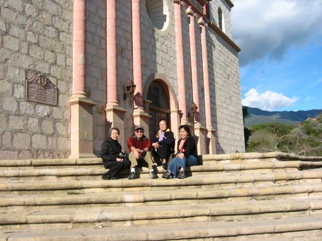
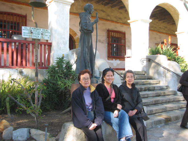
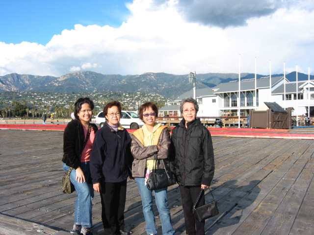
On that sunny Tuesday of January 4, 2005, we had on our map, the mountains of Santa Ynez, as well as some nearby cities situated in the county of Santa Barbara, CA.
We had planned to visit the opulent Hearst Castle in closer San Simeon but backed out at the last minute after we learned from their website, that the shorter route via Highway 1, was closed due to rock slides.
We reached Highway 101 – more scenic than Interstate-5 -after we deftly maneuvered the backdoor of the Santa Cruz mountains using Salinas Road. From thereon, Highway 101 regaled us with its splendid views of mostly vineyards, ranches, a bit of the coastline of the Pacific Ocean in Pismo and Arroyo Grande, and the gentle, rolling countryside of the area tuck neatly between the Bay Area and Southern California.
After we stopped briefly for gas in Arroyo Grande, we were just merely an hour’s drive away from the hotel which we called home for the remainder of our trip. We stayed at the BestWestern-Andersen’s Pea Soup in Buellton, CA. Like most of the hotels in the surrounding area, the design was Danish-inspired. This was due to the fact that Buellton was a mere 5-minutes drive away from the smaller but more popular Danish village/city of Solvang.
There, cobblestone courtyards, windmills, brick sidewalks, thatched rooftops, and cozy coffee shops, offered us already-bored denizens from the dreary, concrete jungle of the Bay Area, the unique flavor of Europe right here in California.
At the parking area of Andersen’s Pea Soup Restaurant in Buellton, CA
After we unloaded all our gear in our hotel room, we wasted no time and hied off to the main city of Santa Barbara, which was another hour spent leisurely cruising 101, with the snow-capped mountains of San Rafael watching us from the distance.
We arrived at the archaic Mission Santa Barbara Church at 2:30 pm – exactly 7 hours after we left Santa Cruz that Tuesday morning. The weather was, fortunately, still crisp and sunny that particular afternoon in spite of rains clouds that loomed from the southern front. An hour later, we found ourselves at the Santa Barbara wharf, where we marveled at the fantastic, time-tested combination of mountains and sea scenery. A place sure to evoke fond memories of one’s glorious past, wherever one may have originated from.
At the steps of the Mission Santa Barbara Church
Near the entrance to the small historic museum in Mission Santa Barbara
A majestic view of Santa Barbara from the wharf.
The tight but busy streets of downtown Santa Barbara guided us in our search for Highway 154 as we preferred to venture the twisting but spectacular San Marcos Pass rather than to return to Buellton using the now, for us, redundant Highway 101.
The Santa Ynez mountains run like a wall along the south coast of California that stretch from east to west. There are only three routes out of Santa Barbara to the north that cross these mountains: Gaviota Pass, Refugio Pass, and San Marcos Pass. San Marcos Pass is the shortest route of these three. The San Marcos Pass summit is about 8 miles northwest of Santa Barbara.
San Marcos Pass, punctuated by spectacular views of Lake Cachuma and highlighted in part by the grandeur of the Los Padres National Forest and the San Rafael Mountains, is probably one of the most scenic roadways in the entire state of California.
The first people to live on San Marcos Pass were the Chumash. They originally called it “Malames”. The Chumash are now gone, but their memories linger on (courtesy of a classy resort/casino) and their rock paintings can still be found in many places on the Pass, among them, the Chumash Painted Cave State Historic Park.
We bade farewell to the San Marcos Pass as soon as we descended 154 and cut through the towns of Santa Ynez and Solvang to finally reach our hotel in Buellton via Highway 246…instead of continuing on to the historic town of Los Olivos – known for its numerous wineries as well as its expansive views of the Santa Barbara Valley. Both Highways 154 and 246 will eventually merge with Highway 101 somewhere along with their respective ways.
We could not resist the charm of ‘Europeanesque’, Solvang so we decided to refresh our flagging spirits by settling down into one of the cozier tables that also offered a nice view of the streets from inside the Mortensen’s Danish Bakery/Shop, where we had their ‘house special’ bread and coffee.
Coffee and some Danish pastries in Solvang, CA
At the entrance of Mortensen’s Coffee Shop in downtown Solvang, CA
The bread’s unusually sweet fillings and the caffeine boost in the numerous cups of coffee we had, gave us back the energy we needed to continue on for the long night ahead. Pictures were taken along the brick-laden streets of Solvang as well as nostalgic sceneries among the horse ranches and the ostrich farm we passed-by, by on the way back to our hotel in Buellton.
It was already dark and the traffic discernably light -except for the brief but gaiety Christmas lights we saw at Solvang as our Jeep plodded back along Highway 246…perhaps wondering where all the magnificent vistas had gone – as we headed for the Chumash Casino and Resort – a convenient 15-minute drive from our hotel.
Once inside the casino, the creations of men and their mighty, money-making (or, shall I say, ‘money-taking’) slot machines plus the ritzy ambiance of the place, once again, tried to mesmerize us with the false sense of beauty of the materialistic-side of things on this part of the Earth.
We already knew better. The natural beauty of the places which we had all seen earlier, was already forever etched in our minds for as long as we will all live…and will be impossible, for any artificial places of recreation that will probably be created by man, to take them all away from us.
The Vigan ‘longanizas‘ (sausages from Vigan, which is a town about 250 miles north of Manila and noted for its rich Spanish heritage) smelled even more garlicky that morning as I placed the remaining links on a clear bowl.
The sausages casings’ red-brown color together with the fat that dripped from the fillings, blended oh-so deliciously, with the generous oil that had accumulated under them. Eaten at breakfast and served over hot, white rice with a good cup of coffee, these ‘longanizas‘ will definitely see you through a long day of travel…which we had planned that Thursday of Dec 16.
By 9:30 in the morning we had already traversed the busy cities that had dotted Highway 880 -and a bit of I-80 – and had coasted cleanly into the towns of Vallejo as soon as we had exited the first off-ramp after we paid the $3 toll in the recently-remodeled Carquinez Bridge. It is one of the major spans that link the upper portion of Northern California with the Bay Area.
Highway 29 cradled us the rest of the way as we headed towards the majestic plains of Alexander Valley, in a place called Geyserville. The destination may not rub well with the altruists, but the journey was, nevertheless, close to being ethereal.
As soon as we left behind the old city of Vallejo, the scenery immediately turned rustic and was perfectly complemented by endless vineyards that caressed the entire length of Highway 29. We passed by quaint towns along the winding roads of Napa and Calistoga.
Both these places offered a study in contrast to over-consumptive materialism and utterly simple living. In addition to their huge manses, there were the usual gas-guzzling SUVs and expensive sports cars casually parked inside the huge lots of the vineyard owners. On the other side of the coin, there were the humble, one or two-room abodes of farmers or retired folks who love to till their own lands.
Passing through these rustic towns also gave me a sense of wonder as to why, we, mere mortals had to endure the banalities of modern living –even when these seemingly plain (but spectacular) sceneries could fill our inherent craving for inner peace and joy, much stronger.
The plains of Alexander Valley unfolded right before our already mesmerized eyes after Highway 29 turned into Highway 128 and almost immediately after we passed-by the last town in Calistoga. Highway 128 meandered along the rollings hills of the Valley until you hit the small town of Geyserville. A short, stone and steel bridge -one of the many that spans the 50-mile long Russian River – should serve as a good marker that you’re on the right track to Geyserville.
Our destination wasn’t the town but the Indian casino now called River Rock. It used to be called ‘Dry Creek Rancheria’ but casino operators -with their esurient skills for making money – probably realized their folly in naming a money-maker that had already dried-out and renamed it to something that constantly flows instead.
The place was situated up a steep hill that was accessible via a narrow road along Highway 128. There were multi-storeyed parking garages and most probably, a hotel, undergoing construction. But, the squat, main casino building was already in full action –ready to take your money away.
The panoramic view of the valley from the 4th-level garage parking offered a bit of spiritual relief from the voracious appetite of the slot machines and gaming tables below.
It’s probably the very first Indian casino that I had been to where I felt that I didn’t even have the chance to win, just a few minutes after inserting my money on the slot machine. The slot machines over there were really tight. Even Larry Ellison would probably shudder at the thought of how those slot machines were programmed to give the house an unbeatable edge.
River Rock, the place, is definitely on my “to visit” list. Eat and enjoy the scenery. But avoid the casino as much as possible, please. You might want to play at neighboring Hopland instead (a 30-minute drive further north from Geyserville).
There, the less-sophisticated slot machines of the ‘Shokawah Hopland’ will welcome you their kinder and gentler arms.
All told, the fantastic sceneries and the grapes planted all throughout Highway 29 that led us to River Rock, only served as mute witnesses, to our follies, perhaps, in our ways for the never-ending quest for something meaningful in life.


")


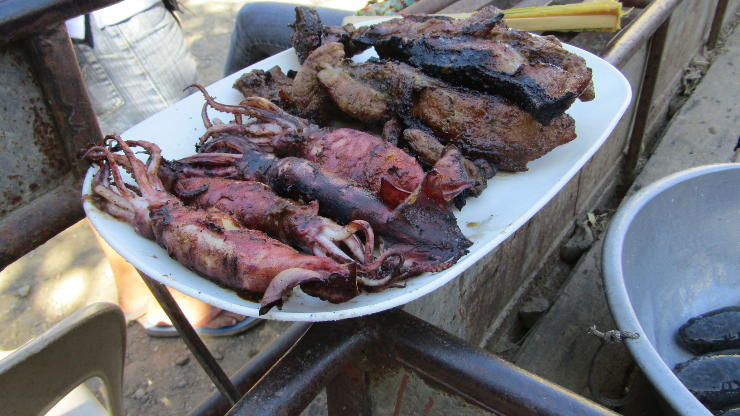
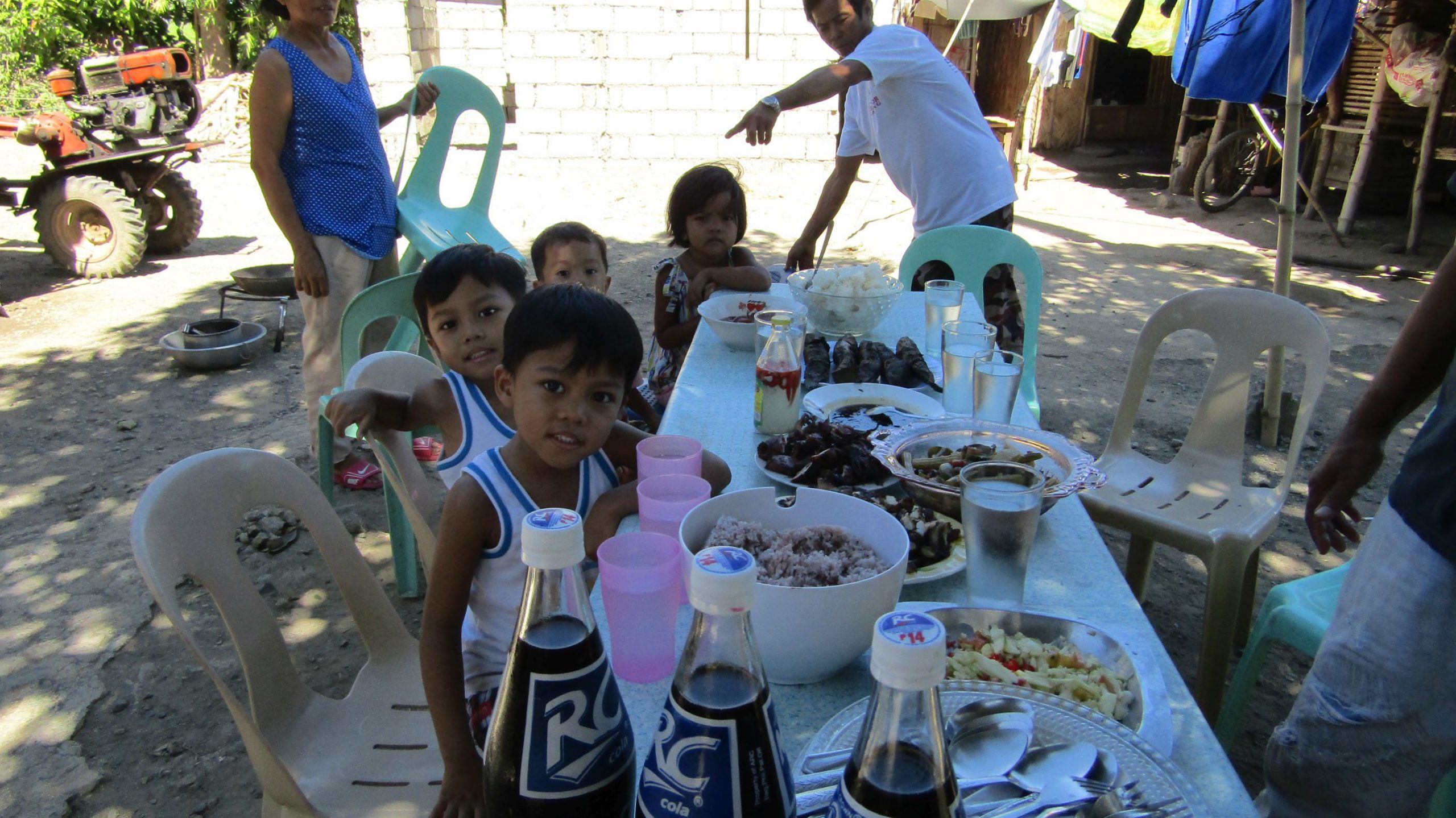
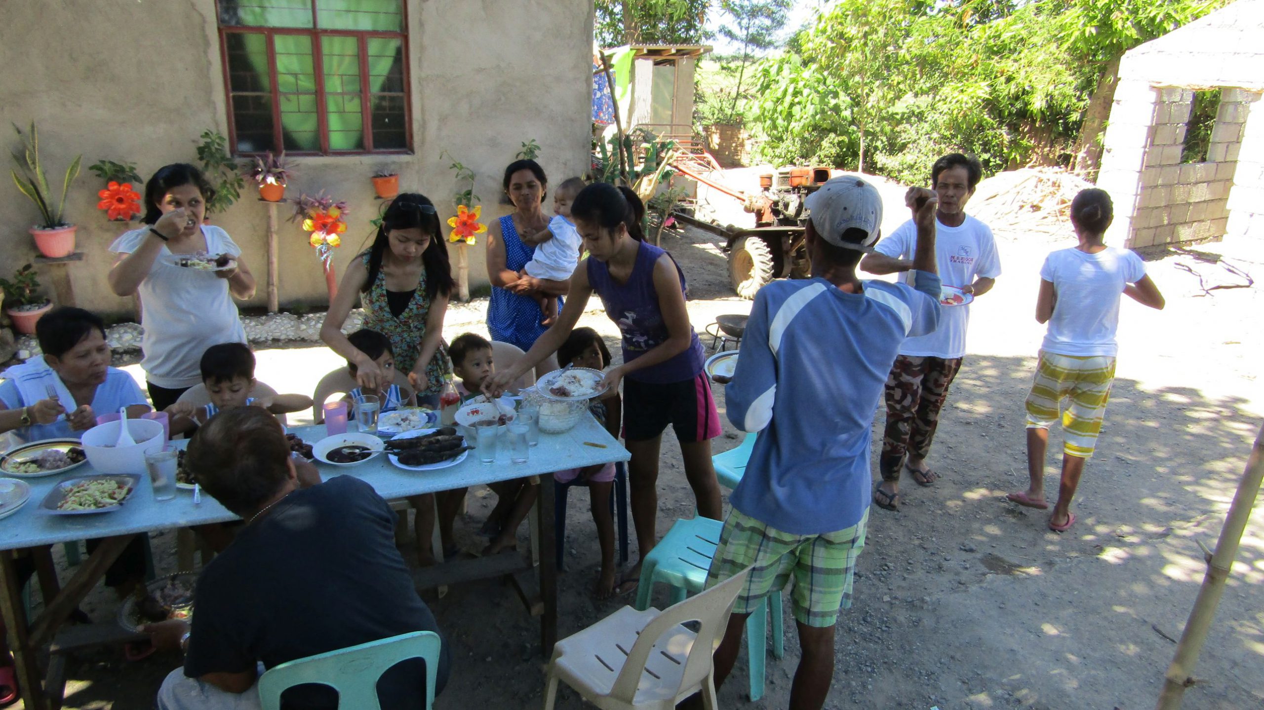
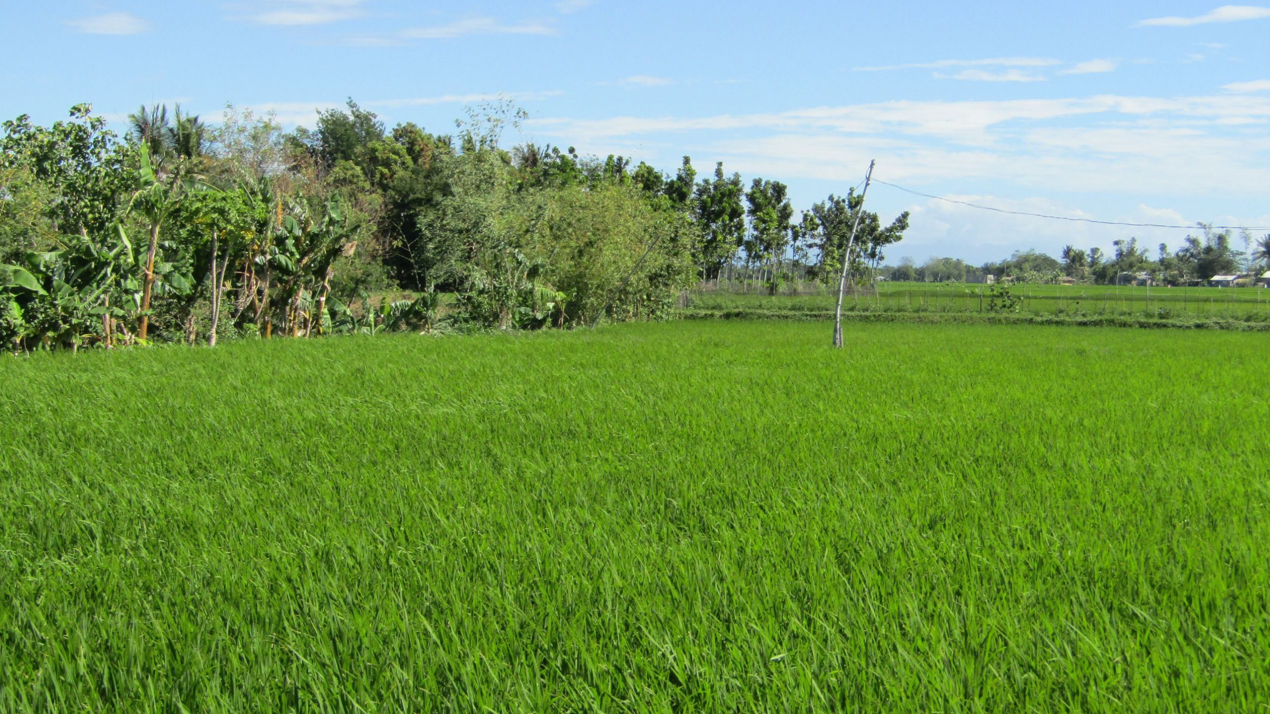
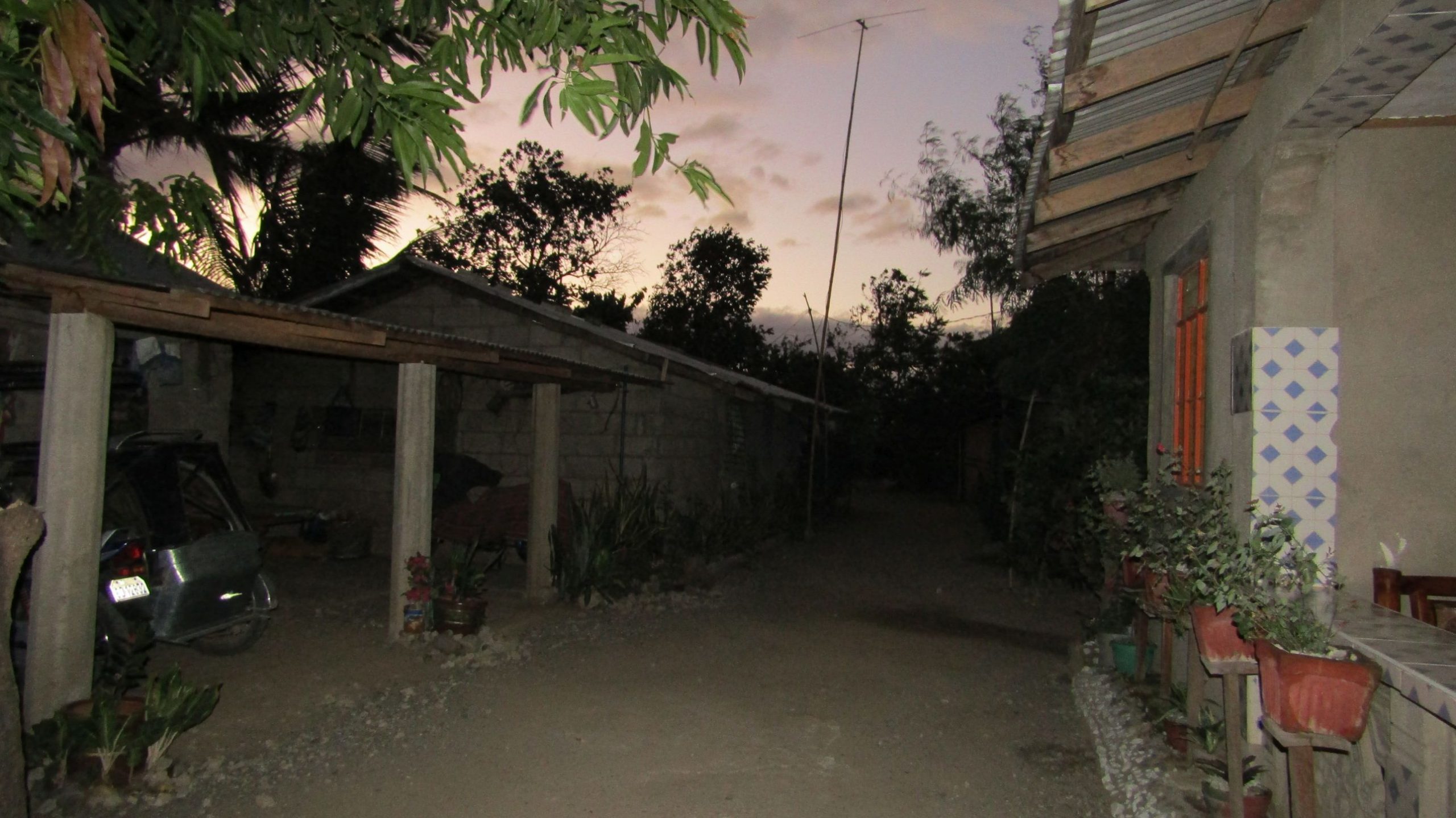
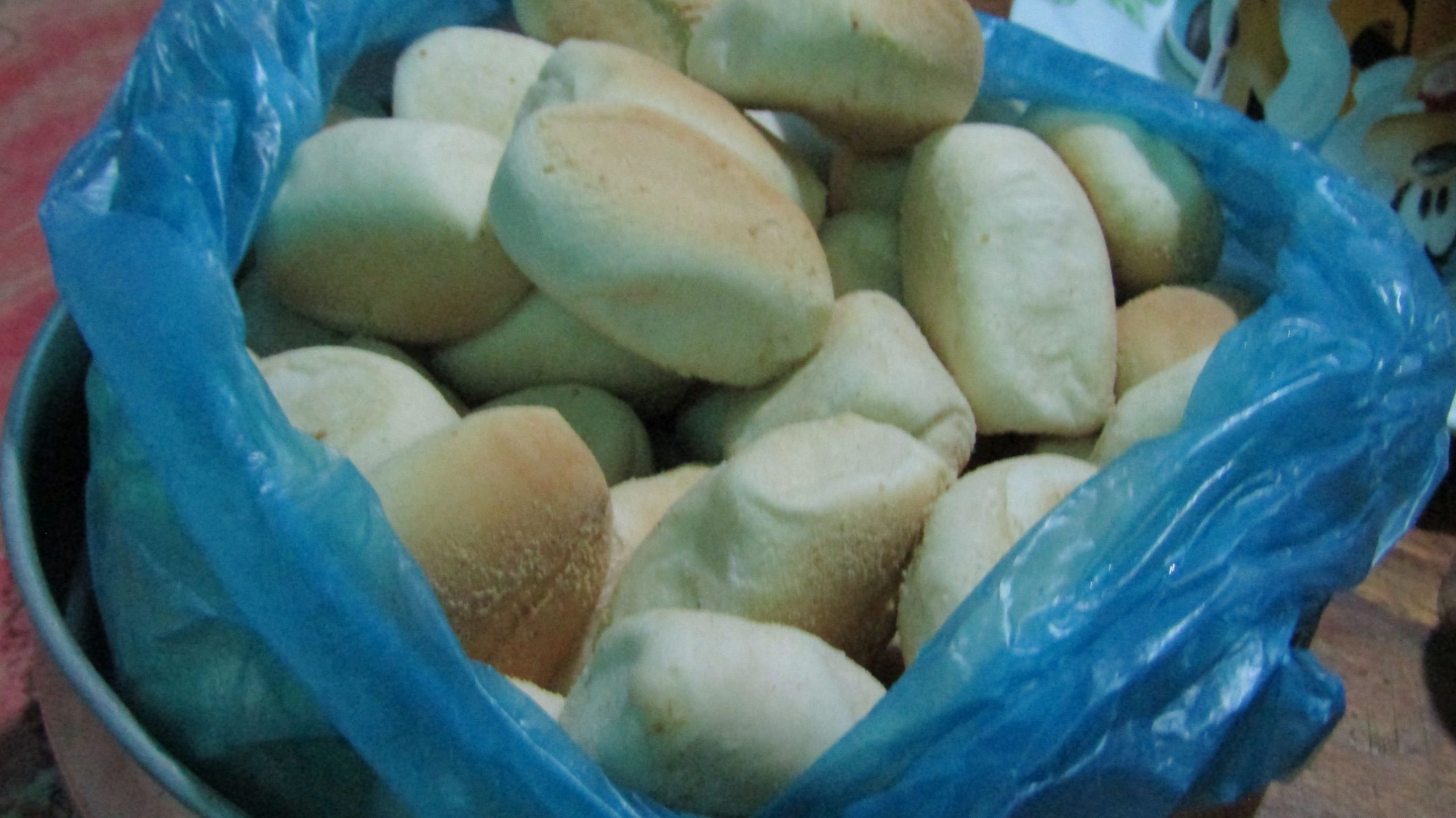
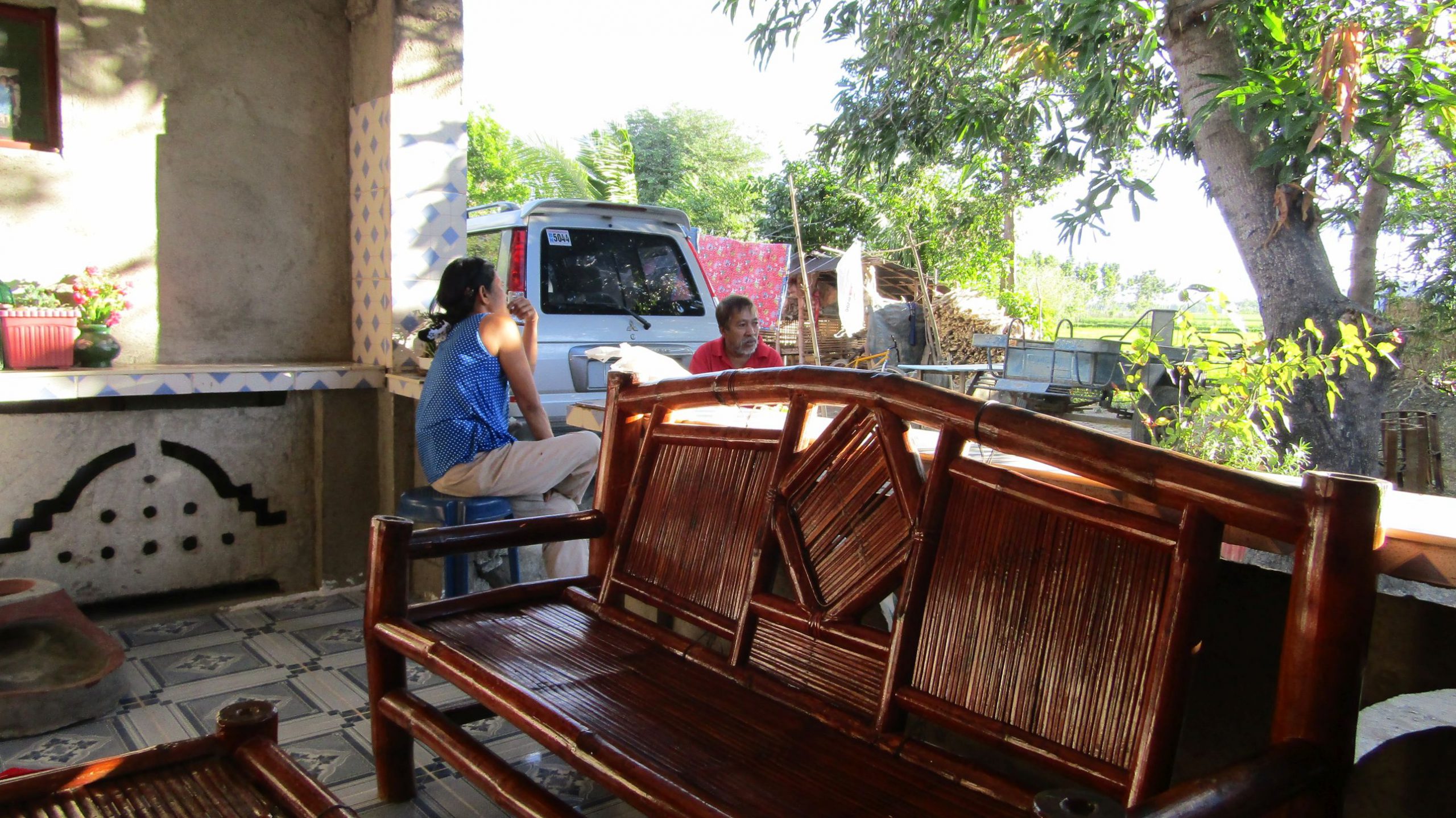
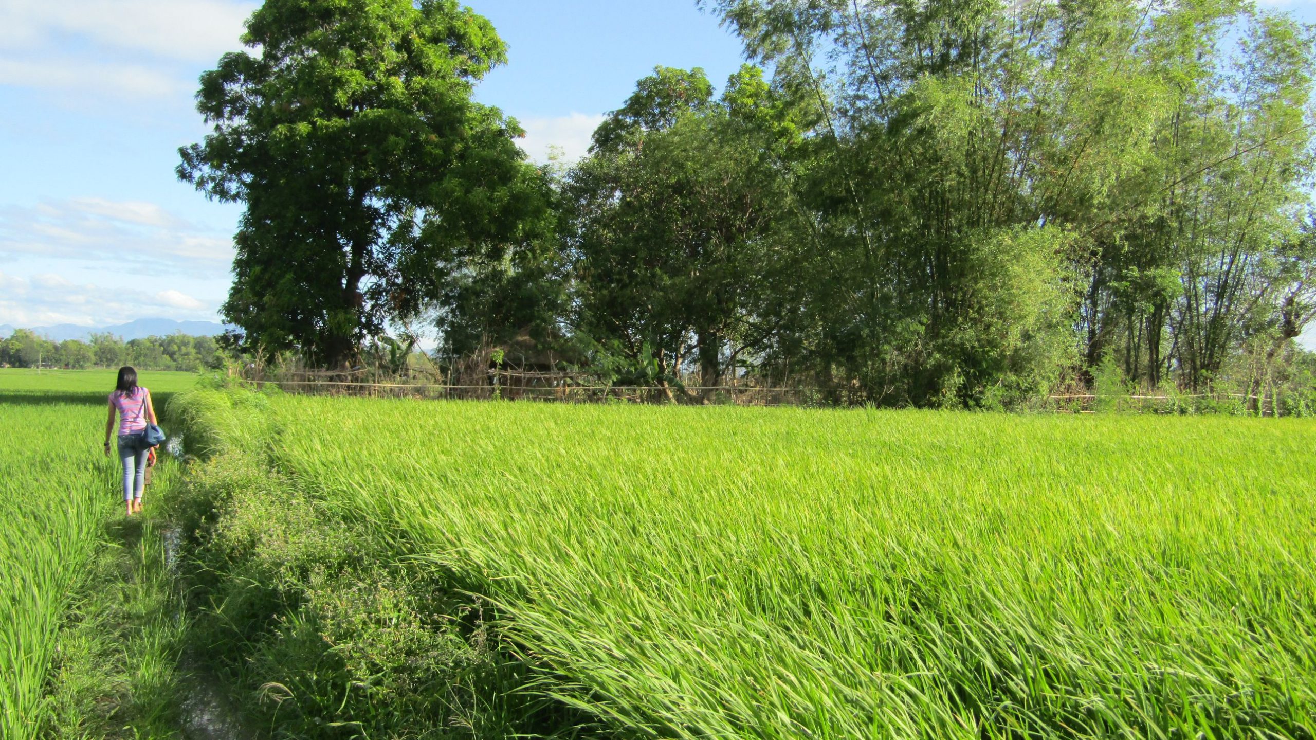
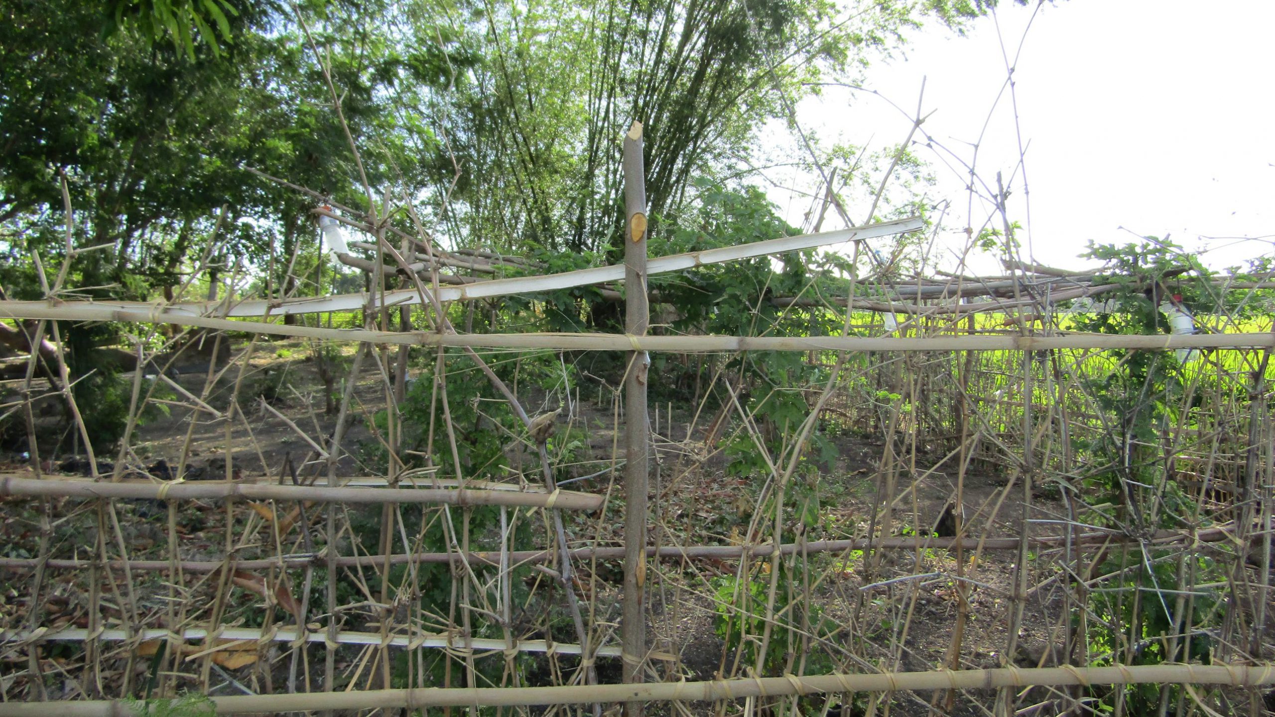
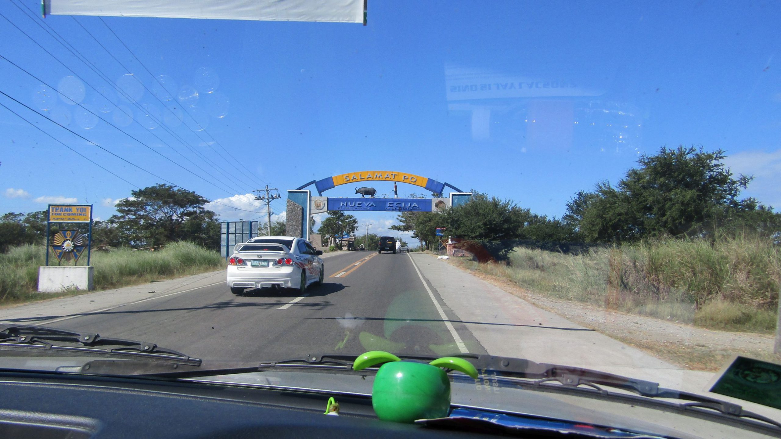
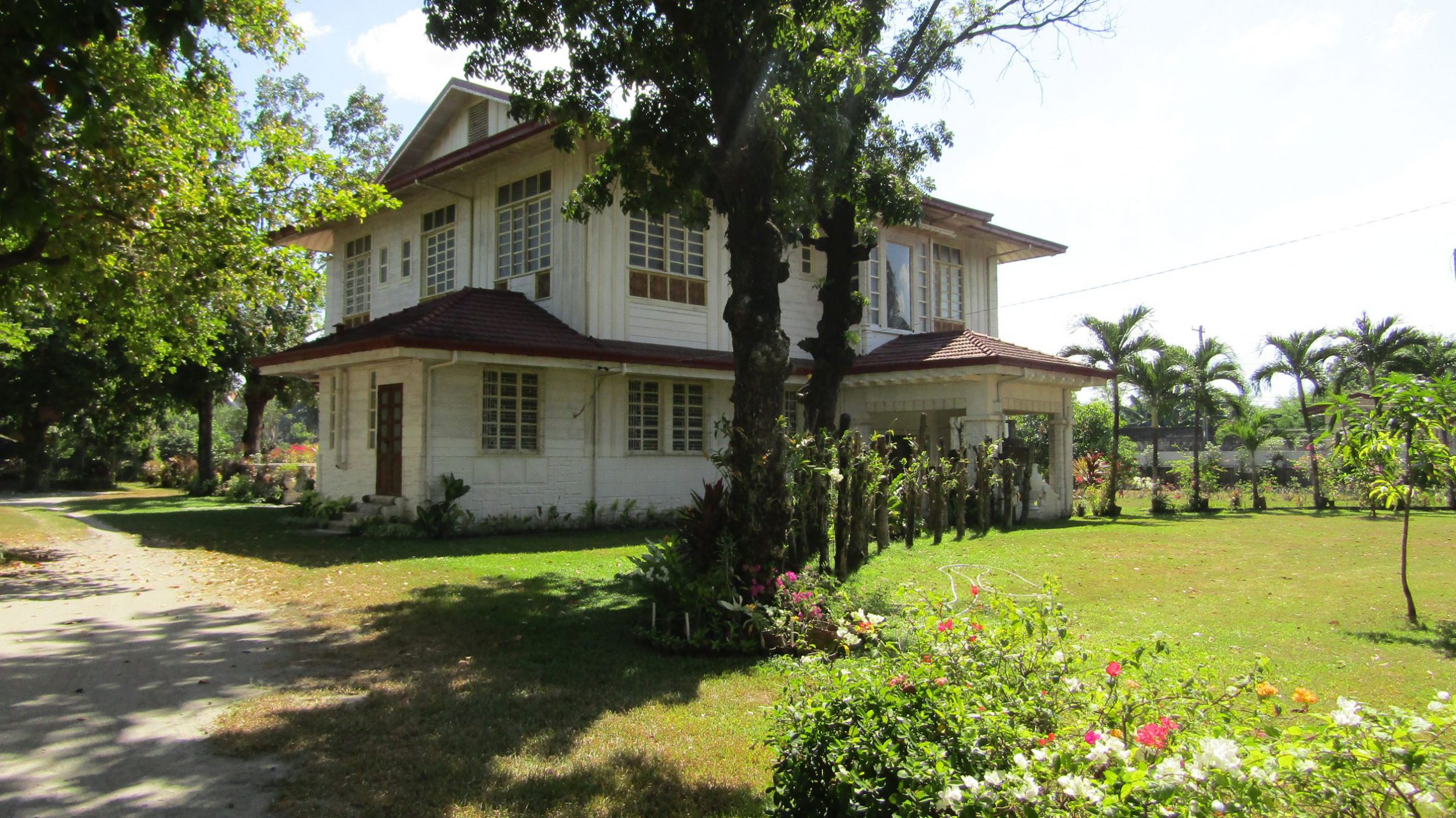


 in Cagbalete Island")


 farming in Cagbalete Island")
 in Cagbalete Island")


")


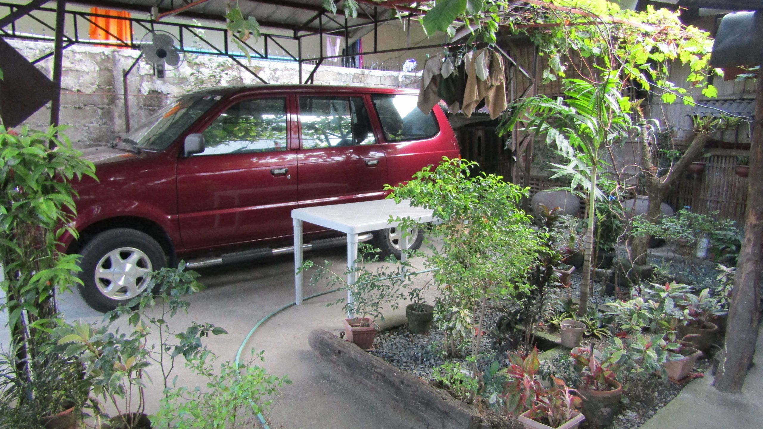
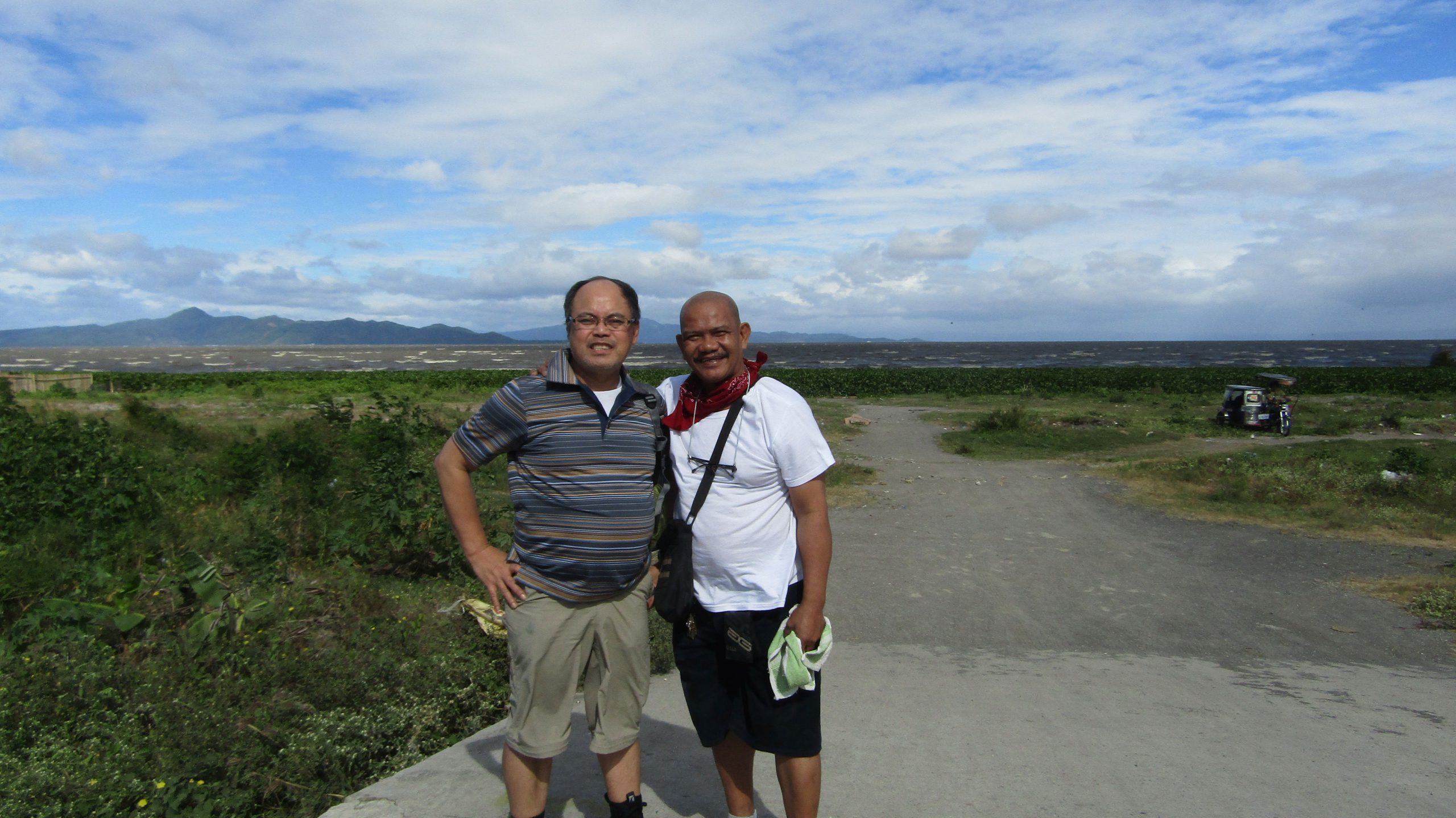
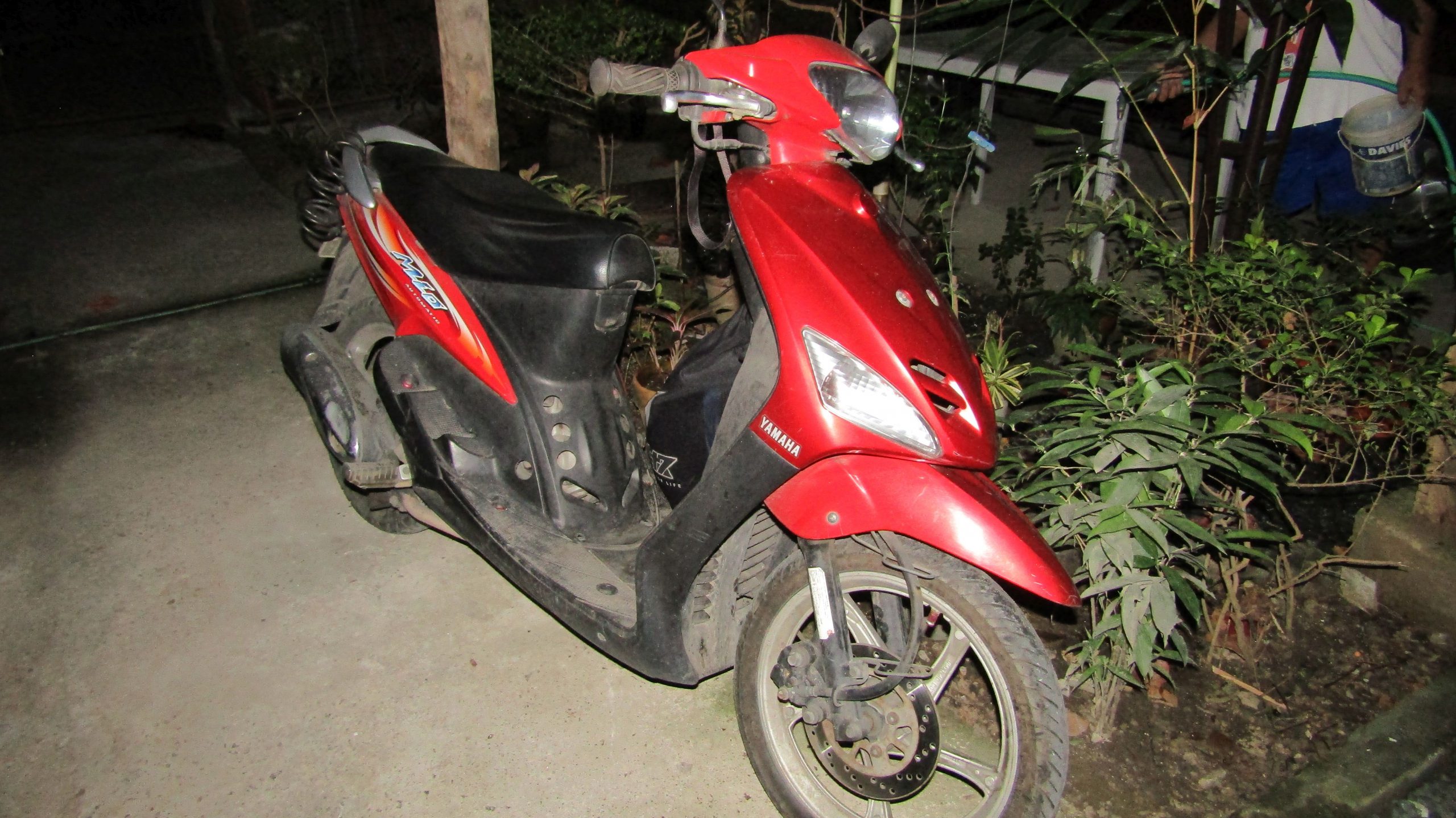
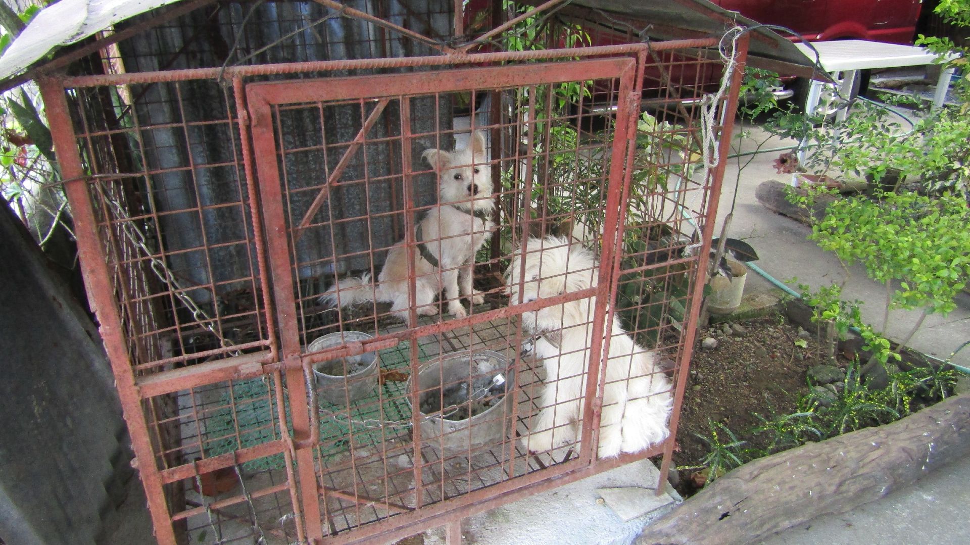
 Richmond-San Rafael Bridge, (2) Golden Gat...")